

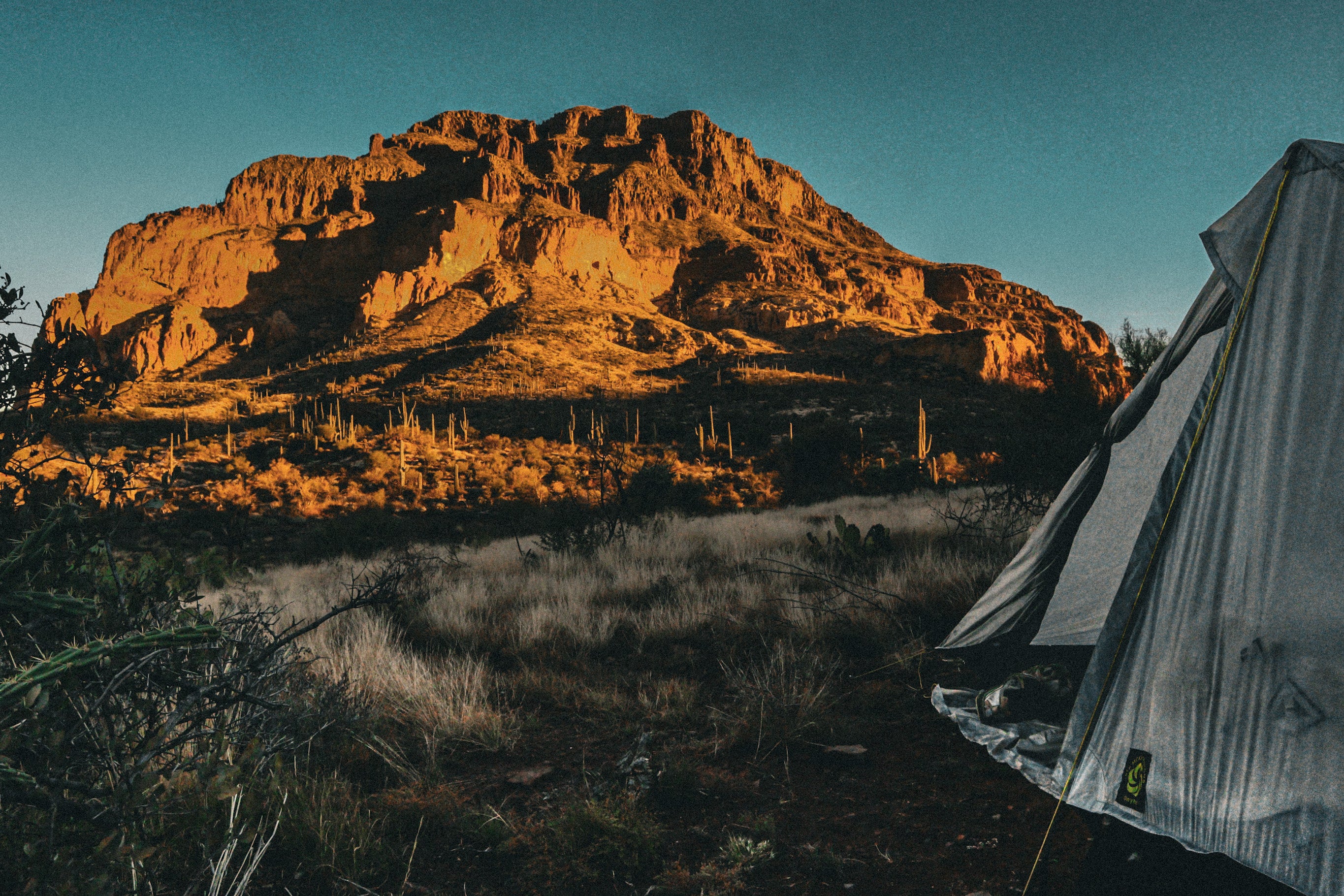
A few weeks ago I completed my thru-hike of the Grand Enchantment Trail (GET), an ~800 mile route expanding from Albuquerque, NM to Phoenix, AZ. First off, The GET is the most beautiful mile-by-mile route that I have ever hiked. From the desert lowlands, to traversing mountain ridges, to fording rushing rivers, to scrambling up steep canyon walls, the GET has truly got it all. Now, you may be asking yourself, “why haven’t I heard of the GET?”. You are probably most familiar with the 11 National Scenic Trails that make up our ‘official’ trails here in the US. Outside of our National Trails system, we have tons of other routes, which simply connect littler trails to create one large trail - like the GET. If you’ve never gotten off the beaten path before, route finding can be a little scary. We’re talking remote, we’re talking burly, and we’re talking beautiful. I’m going to be explaining five differences between hiking National Scenic Trails and Hiking Routes!

One of the biggest differences between hiking National Scenic Trails and hiking routes is what you use for navigation. Before you even set off, you have to purchase the GPX file from the creator of the GET, Brett Tucker. If you’ve hiked any major trail, you are probably familiar with the app Farout (Guthook). This app leads you through your trail, displaying basically all the information
you would ever need. On the GET however, you download the GPX file on Gaia GPS. For those of you who are not familiar with Gaia, it is a hiking app that allows you to navigate and track in the field. I would say it's more descriptive, as you can see the topography quite clearly. Like Farout, you download the file (for offline use) and watch yourself via GPS move along the trail.

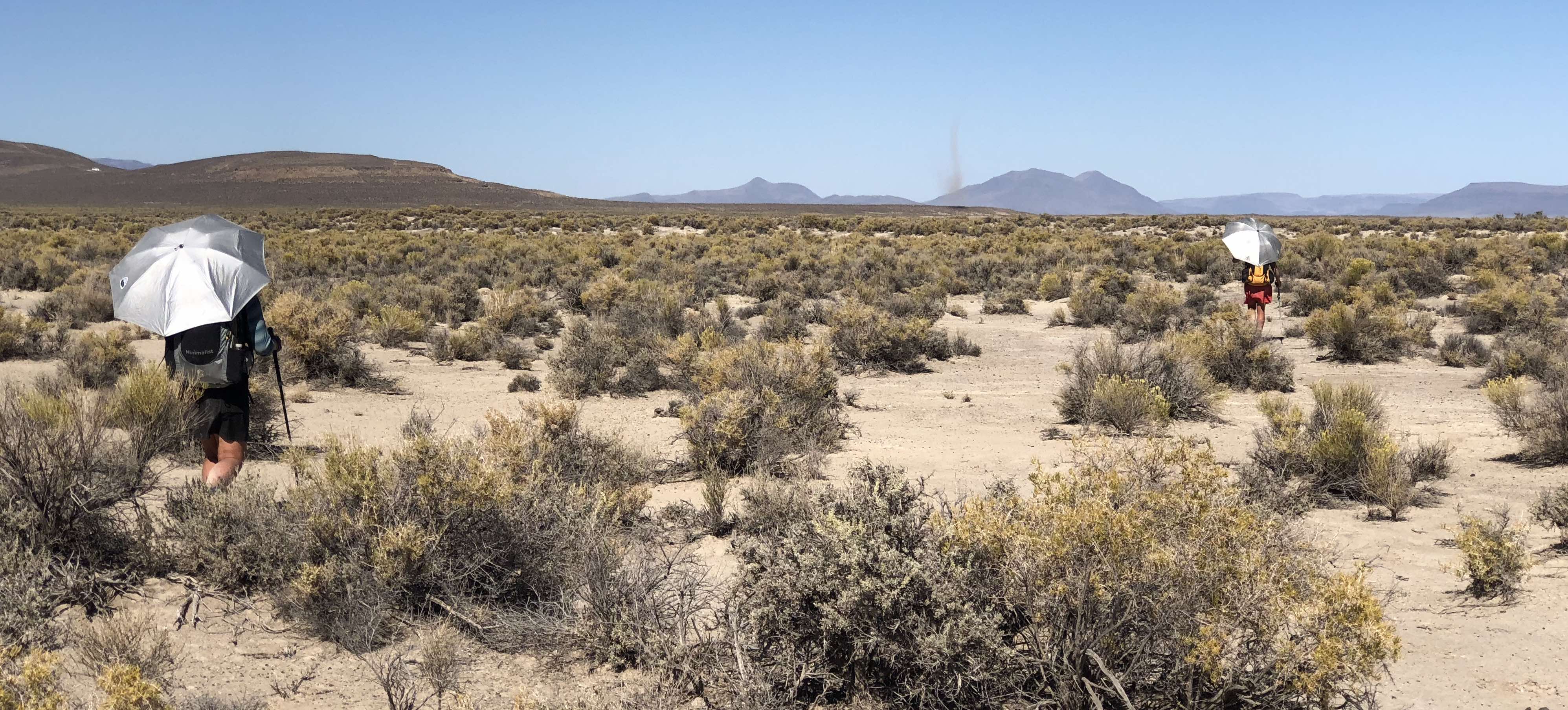
I hate to say it, but Gaia unfortunately just drops the ball sometimes. This brings me to my next point of dealing with the actual trail terrain and dealing with re-routes. The GET provides a lot of off-trail travel, with 60% of it being on an actual ‘trail’, while the other 40% is legit just a point-and-shoot game. You’ll understand why I put trail in quotes in a second. As my partner and I were following Gaia on our phones, there were so many times that it showed we were smack dab on trail, but as we looked around, there was legit no trail at all. There was one time that we were coming off a mountain that was covered in thickets and cactus and our only path down was the path of least resistance. It’s the kind of trail that you take turns leading to blaze the path. Thinking about the AZT, there’s a well-established path the whole way and not a likely chance that you could get lost. The GET goes through terrain that hasn’t been maintained in years. You’ll go over mountain passes by simply just following game trails. It’s a
crazy experience for someone who has never been in this situation before. Throughout the GET, there are a couple re-routes that had to be made because the BLM land and forest service land that the old trail used to go through is simply impassable. I’d say that if this trail is on your radar, you better get to it soon because it’s all about to be too overgrown in general.

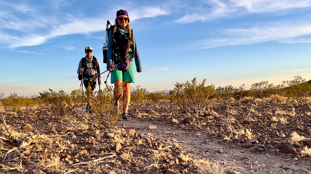
An obvious difference between hiking National Scenic Trails vs. hiking routes is the amount of people seen on trails. I was one of 14 that hiked the GET this year. As my partner and I were on trail, we didn’t see a single other GET hiker. We also went days without seeing another soul. There were many times throughout this hike where we would come up on a mountain, look around and say, “oh my gosh - I wonder how many miles away we are from the next human.” In the whole 800 miles, I think we maybe saw less than 5 day-hikers, with the majority of the people we came across being hunters or trail crew. As someone who enjoys hiking solo, I cannot express to people enough how important it is NOT to be solo when hiking this trail. The remoteness is something unlike anything you’ll find on any National Scenic Trail. In my experience, it’s better
to have two brains working together to try to find the path of least resistance than just one.

If you don’t have an app or a guide telling you how far away it is to the next water source, how are you supposed to know? On Guthook, there are icons that show you how far it is to the next source. On the GET, we kind of had no idea how far it was going to be from one to the next. There is a live google document that has all of the typical water sources listed that are on the GET, but that hadn’t been updated since May...and we were hiking in September. I will add that Gaia GPS does have some springs listed, but there’s no way to know if they’re flowing or not before you get there. Before we started this trail, my partner researched the previous monsoon season to try to have an idea of what the water sources might be like. The monsoon season brought a bucket ton of rain, so that’s how we decided to do this trail. We didn’t know where we were going to find water, but we knew it had to be out there. Early on in the hike, we made a rule that we would not pass up ANY water source. As we put a couple hundred miles beneath our feet, we learned that there was actually more water than expected. I guess you could say that finding water on the GET is about taking chances and having luck. I will say though, from cow ponds to cow troughs, there was not one bad water source on the trail, some of which I didn’t even filter!

If you’ve hiked any National Scenic Trails, you’re probably very familiar with trail towns. These towns love hikers and the hikers love them. When hiking the GET, the trail goes straight through some towns, while you have to take a reroute to get to others. Regardless of what towns you go through, don’t be surprised if
people have no idea what the heck you’re doing. As my partner and I were hiking through towns, we realized that not many folks that live in these ‘trail
towns’ are familiar with GET hikers. Whether it be getting a hitch into town, chatting with our waitress, or just walking to the post office with a pack on, everyone wants to know what you’re doing. Because thru-hikers look like aliens to most of these people, it’s important to be kind and respectful in each of the little towns. We as hikers want to leave a good reputation in places like
these. You never know who you may inspire. All in all, please be courteous when going through small towns on routes like the GET.


She’s rugged, she’s burly, she’s remote, she’s dang beautiful. The GET is a route that is quite different from any of the National Scenic Trails. When preparing for a trip like this, it’s important to do a lot of research so you know exactly what to expect. It’s not about the destination, but the memories made within each mile.


Leave a comment
This site is protected by hCaptcha and the hCaptcha Privacy Policy and Terms of Service apply.