

Background Info:
So you think you want an adventure. Here is a complete trip report narrative from the Upper NF Smith Headwaters attempted run on December 4, 2023. This trip came together with lots of planning and access to local knowledge, a gift that the boating community has developed over time with the people of Gasquet in large part due to the legacy of Bearfoot Brad (Brad Camden). Bearfoot video Brad has been running shuttles for whitewater boaters on the Smith for a long time and is also an advocate for river conservation. You can help protect the Smith by signing the smithriveralliance.org petition. Planning this trip, we needed places to stay in the middle of a winter storm and shuttle drivers who would be capable of handling unknown forest road conditions. David Gasteneau has taken over for Brad on the local shuttle front for the last few years. He connected us with Tom Stewart who would do our shuttle. Plan A would be to boat the North Fork of the Smith from Major Moore’s to Margie’s on Sunday to get the crew warmed up, then to go into the NF Headwaters the next day. I was able to secure the contact info for the people who own the cabin at Major Moore’s and they agreed to let us stay there Monday night. We were also able to call in a favor and rent the Ludlum house on the Winchuck River for Sunday night, even though it is technically closed this time of year. That would put us an hour of driving from the put-in spot I selected off rd 270. There were a few hiccups with plan A, however.

The Gauges
The Smith River has three forks and there are two gauges that boaters typically use.
The first thing that went awry was the Jed Smith gauge. Jed Smith reports the total from all three forks. It stopped reporting data during the final 48 hours before the trip. There is a more relevant gauge located at the “pipe” on the north fork, at the confluence of the north fork and the middle fork. The pipe does not report digitally. It is just some spray paint and if you want to check it then someone has to go do a viewing in person. At high water the pipe gauge can also be inundated with the back eddy water from the Middle Fork, making it less reliable of an indicator of pure NF flow. The pipe is measured in feet and between 9 and 12 feet is a great moderate flow. I was able to watch the predictions for the Chetco drainage and also the digital gauge at Dr. Fines Bridge for some correlating data. The predictions’ timing and flow looked good, but the morning we were to head out to the river, the real-time data blipped in at about 51,000 cfs on the Smith. We were hoping for 20,000 and dropping at the most. The storm that came in hit way harder than predicted so we re-routed our Sunday plans to a different drainage. This was a unanimous decision, everyone felt good about the re-route. We had 12,000 on the Illinois at Kerby gauge. We went to Deer Cr onto the Illinois and also got in a lap on Rough and Ready Creek. We developed some good community connections there, connecting with the folks who control the private gate on Rough and Ready. We also got in the groove for high water boating. This was the first flush for the general boating community here. We had a crew of 9 small craft and 4 rafts on Sunday. The Gasquet locals were reporting that the pipe gauge was at 18 ft Sunday night.

Choosing a flow window
To guesstimate what would be a good flow for our team, including a small raft, we based our information on the flow window that would be considered moderate at the pipe gauge for a trip launching from Major Moore's. In my opinion, the best moderate flows for the classic North Fork Smith are between 9 ft and 12 ft on the pipe gauge. I was thinking the upper end of that window would work for us on the headwaters run due to how tiny it would be at the very top. We were aiming our storm-chasing window for after the peak and hoping for several days of falling flows during warm weather. The timing was a little tight, it peaked a little late and over twice as high as we wanted it. Peaking at over 50,000 CFS on Jed Smith gage Sunday morning. So then the question was, how much would it drop in the next 24 hours while we were en route to the put-in? Would we still go? Would our group accept the added risk of a high-water trip? Were we all willing to embrace the possibility of hiking out? It peaked at 50k and by the time we launched, we had about 20k. Twice as much as desired.

About having a high water skill set
Oh, the River Rating System. I would personally consider the skill set needed to do a high water run to be one full level above what the run would be rated normally. So for instance, if you're going to go do the North Fork Smith (which is rated class IV) above the standard moderate flow window, then you should have a class V skill set. Arguably, the run itself bumps up a class during a high water event. Even if the moves aren't more difficult, the time that you have to make decisions and execute maneuvers is dramatically less. The consequences of accidents become higher. Losing boats and long swims. High water read and run skills are also best developed on roadside access runs, moves like brush dodging and non-eddy catching are things you can practice in places like the Upper Applegate and Canton Creek with lower consequences than in a backcountry setting like the NF Headwaters. Key components of a high water skillset include tight team boating to manage boat spacing, team eddy catching, safety eddies at wood features, fast decision-making, and looking further ahead than normal. Looking further ahead is both literal and figurative. More on that in the Boating the Headwaters segment.
Decision time
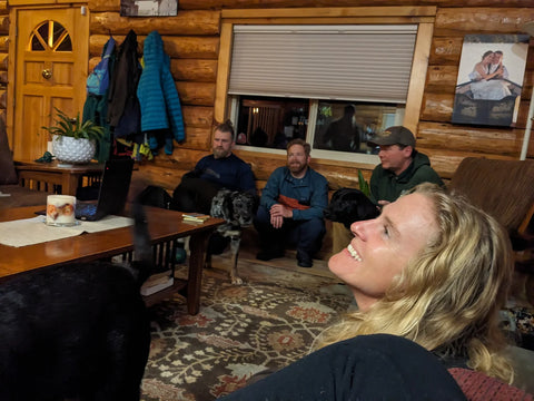
The Sunday night convene involved a pretty intensive discussion over at the Aaron Babcock house. We laid out all the possibilities, we were somewhat pigeonholed into either committing or not to the Headwaters mission as of Sunday night because our shuttle driver would have to leave at 5 am to start the day and they were ready to go to bed. Waiting until morning to check flows/ make a final decision was not an option. We knew it would be high, but also were willing to commit to a “suffer fest” for the sake of exploration. Ted and Aaron dropped out. We decided to at least go look at it. That's more water than we wanted, but it was dropping fast. We would hike out if we got there and it looked bad. The remaining core crew was a good manageable group size of five.
Ludlum Cabin
When we got to the Ludlum cabin, it was pouring rain. We parked in a 4-inch deep puddle of water and used our code to get into the cabin. The Gold Beach Ranger District was willing to make an exception for us to rent out of season if someone came in person and made the payment. Gold Beach is 4 hours from my house, so we did some internal communication and were able to secure it using the help of locals. We saw a Barred Owl swoop down and have a midnight snack. We built a fire and went to bed early.
1107 to 270 route
In the morning, Dave showed up and dropped Tom off with us for the drive. Tom reported that flows had dropped to 16 ft on the pipe. We drove another hour up. We had satellite images researched the route ahead of time and were confident that the 1107 sees a lot of traffic and is in good enough shape to drive. There was a full-sized van located parked in a ditch though, which seemed questionable as we drove by. It was dark out when we left the Ludlum house, we could hear the Winchuck River raging outside, and it was still raining. As the light broke we saw fog and an immense coastal forest. The road was in great shape until we came across a road-wide double hardwood log, maybe 18 inches across and too low for Josh’s nice big diesel truck to duck. This is one of those points where we should have turned around. However, we happened to have a chainsaw, a tow line, and the diesel 350, so we went ahead and cleared the road. The Most Valuable Player award goes to Josh Bowling there. Road clearing set back was about 1 hour, at which point I began to suspect we would spend the night out in the forest. The entire mission is a race against daylight, as is always the case with winter boating in Oregon. We found the junction of 270 and 276, which was to be our drop-off point to begin the bushwhack to the river.

The Hike In
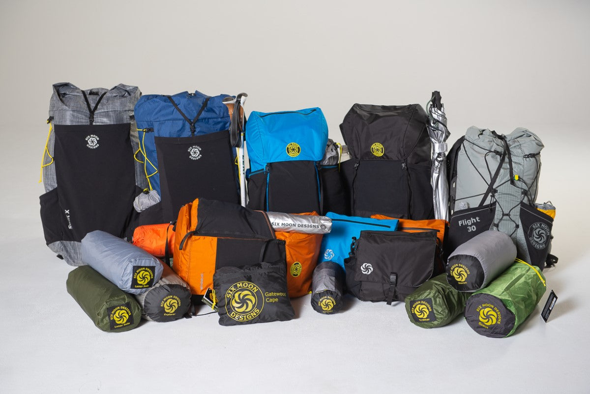
The hard shell kayaks started with boat turtle style but quickly advanced to sled style for the descent due to overhead brush. Side-hilling was fairly problematic and both hard shellers chose to follow a small drainage off to the left of our descent route. For the inflatables, both boats were rolled and placed into Six Moon Designs backpacks, which are intended for pack rafting. These backpacks are capable of holding a blue barrel, the style used for canoe portaging, etc. For the inflatable kayak, I found the pack to be a really good fit. For the raft, the straps were not long enough and the load was difficult to stabilize laterally. The hike was maybe 800 ft of vertical descent.
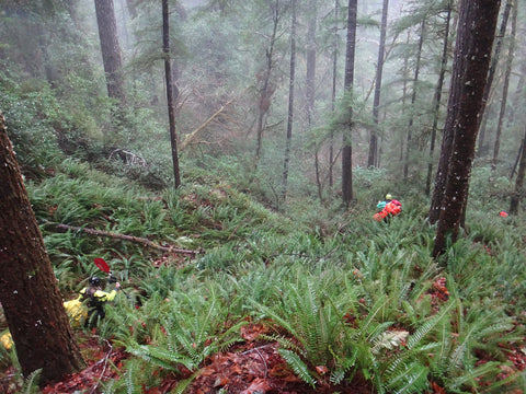
We started at the junction of roads 270 and 276. Then dove off the cliff into the brush to the left. The river down below is arcing in a right-hand turn in this area, and if you veer left or upstream, you hit another small drainage coming from the road grade. I had checked out the satellite imagery ahead of time and it looked like we could bushwhack slightly upstream and stay in the older forest (hopefully less brush).

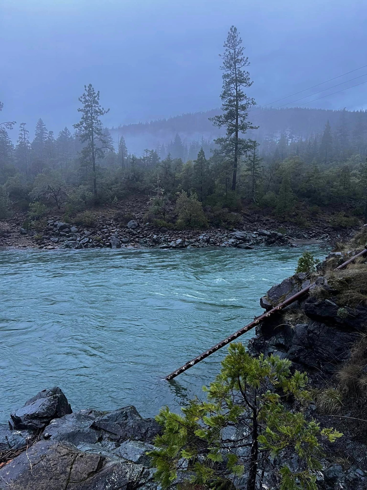
The Evergreen Huckleberry and Vine maple was fairly persistent. Downed trees within the brush exacerbated the difficulty. We saw a giant Pacific salamander! It was wiggling away in the ferns, running from us scary giants. Going down the bottom of the drainage to our left was clearer than riding the ridge as we had originally anticipated. We popped out at the confluence of our small drainage and the Upper North Fork Smith. It looked juicy.
We were in walkie-talkie communication with Tom until we got to the river. It took over an hour or more to get down the hill. Tom waited for us all to arrive at the river before departing with the truck. We wanted that safety net just in case someone were to be injured on the bushwhack or the river were to seem too high when we got eyes on it.

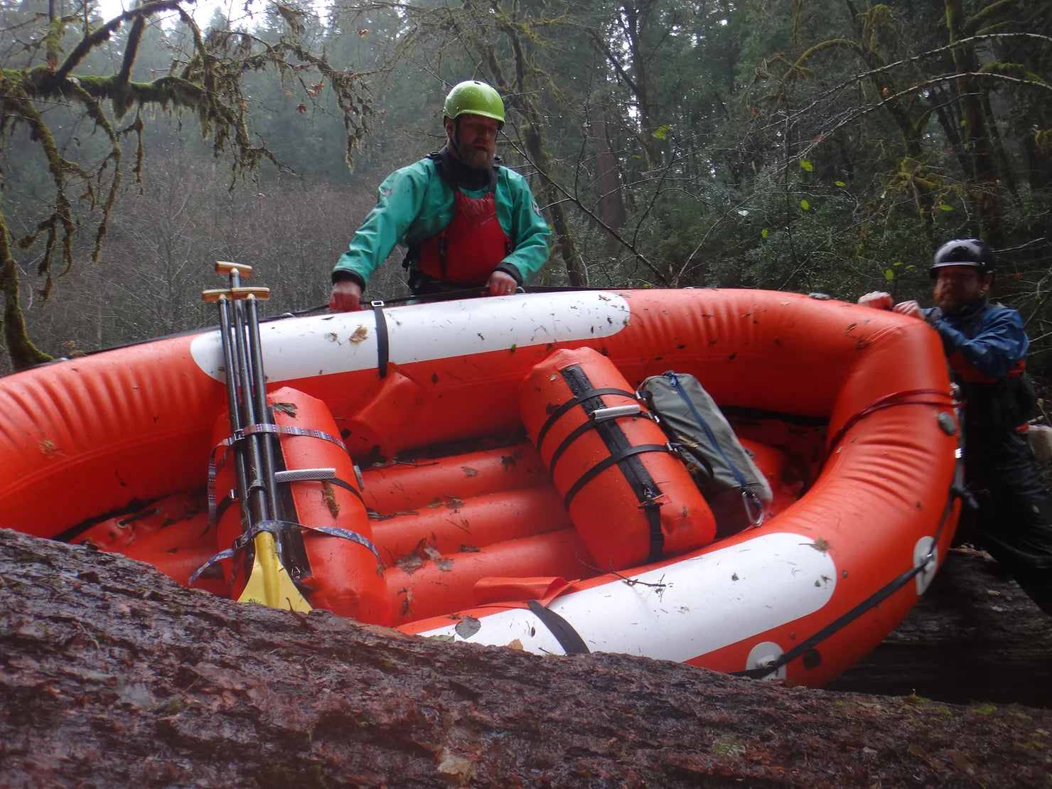
Group size for expedition boating
The group size is an important consideration, in having enough people as resources to help if someone is injured, but not so many people that boat spacing becomes an issue or eddy catching becomes too tight. Another thing more people add is more time to do every scout and portage. We have one small raft, one IK, and two hard shells. I felt like this was ideal. In the inflatable kayak could go out front and easily jump in and out of the boat at difficult-to-access locations for portaging, helping to catch the other craft. The inflatable kayak, however, is also the most likely craft to create swimmers on a difficult run like this. It tips easily, I can’t roll it. The point person is much more exposed to hazards and potentially the need to self-rescue without assistance from the rear group members. A swimmer can go surprisingly faster than a boat and getting swept out in front of the group is a real concern. Which did happen.
Leave a comment
This site is protected by hCaptcha and the hCaptcha Privacy Policy and Terms of Service apply.