

Hikers who have completed a 2500 mile thru-hike, whether it be on the PCT, CDT, or AT, like to think of themselves as badass. Regardless of experience, conditions, or time, hey, you had to be something special to come all that way. You now consider yourself a full fledged mountain goat, right? And then there is Oman.
My wife and I had just gotten off a successful hike of the PCT in 2022, finally gone back to our home in Thailand, and found ourselves revisiting old visa applications for Oman, a country in the Middle East that had previously perked our interest due to its varied landscapes (desert, sea, and mountains), freedom to wild camp anywhere in the country, and reputation for being incredibly safe and friendly. Yet we had no idea that several months later we’d be standing at the base of a 5000 foot cliff in the village of Bald Sayt, following a series of colored paint marks up through the rocks, seemingly put there by rock climbers trying to forge passage through the easiest or perhaps only route through what appeared to be an impenetrable wall.

We were climbing hand over hand on exposed ledges, with “step ladders” often created by loose rocks getting you from one platform to another. Doing this with full packs made things even more precarious, and while we could thank the stars for having ultralight gear, having to throw in a minimum of 3-4 liters of water each with no water sources available until our camp at the end of each day turned our packs into bulky refrigerators, constantly threatening to throw us off balance and hurl us into the abyss below.

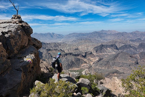
Oman actually has a mountain club and much work has been done to mark the selection of numbered routes that cross the wild, rocky, and arid Hajar Mountains. While not having any kind of sequential order, the W24a eventually led us to the W9, and some days later we traipsed up both the W4 to the country’s highest peak and shortly thereafter a 2-day 25-mile route with no water on the W35. You’d think with all these numbered trails and route descriptions online that there would be a ton of outdoor lovers out walking, but during our 2-week traverse of the Western Hajars we saw exactly zero other trekkers, yep, zero, save for a couple of Swiss gals and three Omani guys who were going for a day hike up the Jebel Shams summit, probably the most popular hike in the country.

Then again, it’s easy to see why there were no trekkers. The routes through the Hajars are not for the inexperienced. Unlike the smooth groomed switchbacks of the PCT, Colorado Trail, or other American thru-hikes, everything in Oman just goes straight up. Additionally, there really isn’t even the faintest bit of a “path,” rather, just paint marks that have been put on a selection of the rocks you are walking or climbing on. Trail runners might not be the way to go in Oman, as hiking here is like walking perpetually on marbles, and ankle twisting or worse is a pretty real hazard. GPS tracks we’d gotten proved to be invaluable here, as we often lost paint marks in the stony and often featureless terrain, and having a good sense of navigation and knowing how to use a map and compass are pretty essential here.

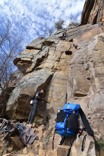
Ultralight gear companies might want to start testing their gear here. Then again, that might not be very profitable. Jagged limestone, every single plant, tree, or shrub festooned with thorns you could use as sewing needles or worse, and ground so rocky that future visa applications might require free standing tents ensured plenty of gear failure. Our Six Moon Designs Haven Bundle and my Minimalist pack passed muster, but not without coming away battered and bruised. Half of our tent stakes broke, the side pockets of our packs got ripped to shreds, and even the non-natural elements attacked with a vengeance. Hungry goats were the only company we had on the high plateaus, and given Oman’s barren mountain terrain, the afternoon and evening visitors to our camps didn’t seem to distinguish between weeds, energy bars, and tarp fabric! Daily mileages here also were humbling. On the PCT, once we hit our stride a 25 mile day was a piece of cake. In the Hajars we were lucky to pull off a mile an hour, and a 6-7 mile day ensured an absolute “knockout I’m wrecked” sleep. We learned to take it real slow, make good decisions, and just savor the solitude.
Reading through the guidebook we had on the Hajars, the author discussed the different types of trails we were encountering. There were “laden donkey tracks,” which we soon realized were just a not-too-steep canyon full of rocks that a loaded down donkey could successfully navigate (not a trail mind you). Then there were “unladen donkey tracks,” meaning that a loaded donkey could no longer handle the terrain. The next step up were “man tracks,” which meant vertical climbing on slopes that even an unladen donkey couldn’t traverse. Even worse were “extreme man tracks” and “exposed man tracks,” essentially Class 4 scrambling with a hell of a lot of air beneath your feet, and something that you might even want a rope for. The fact that the W8 was only a man track had me assured that the route we were on couldn’t get any more steeper or dangerous, but at the same time had me quaking in my boots imagining what an oncoming exposed man track would look like.

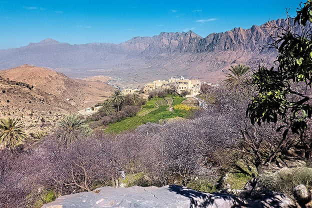
Before Bald Sayt we’d hiked 7 miles over an precipitous rocky pass above the Jebel Akhdar plateau, descending into the gorgeous small mountain hamlet of Wakan, where orchards of apricot trees were blossoming. While the mountains of Oman are brown, barren, and dry, they contrast with the villages that inhabit them. Villages here feature elaborate irrigation canals known as falaj, where sloped channels of stone funnel water from wells, rain, or wadis (canyon washes), and this water turns these mountain villages into veritable oases, full of date palms, barley, fruit trees, and roses (Oman is the world’s largest exporter of fragrant rosewater).

Modernity is a recent thing here. Roads reaching into some of these high hamlets didn’t arrive until as late as 2010. Prior to that villagers traveled to the plains via donkey, utilizing many of the routes we were walking now. Children attended boarding school in towns below, ferried each semester by helicopter, all paid for by the Omani Sultanate! These oases were just as welcoming for us, as we usually arrived late in the afternoon down to our last sips of water and ready for some shade. On our third day out, we reached Al Suwjara, where a tiny stone village built right into the side of a cliff had been abandoned by the six families who lived there, favoring a newer spot with road access higher up across the canyon. Wanting to preserve their old birthplace, the families turned the cliff home into a luxury resort, where adventure travelers fork out for a chance to spend the night in one of Oman’s most remote places. Rooms here were a bit out of our budget, but in true Omani hospitality-style, the owners invited us to camp for free inside the property, giving us a platform inside a cave looking out on the valley! We took advantage by splurging on the resort’s all-you-can-eat buffet, calorie-loading for the next day’s trek.
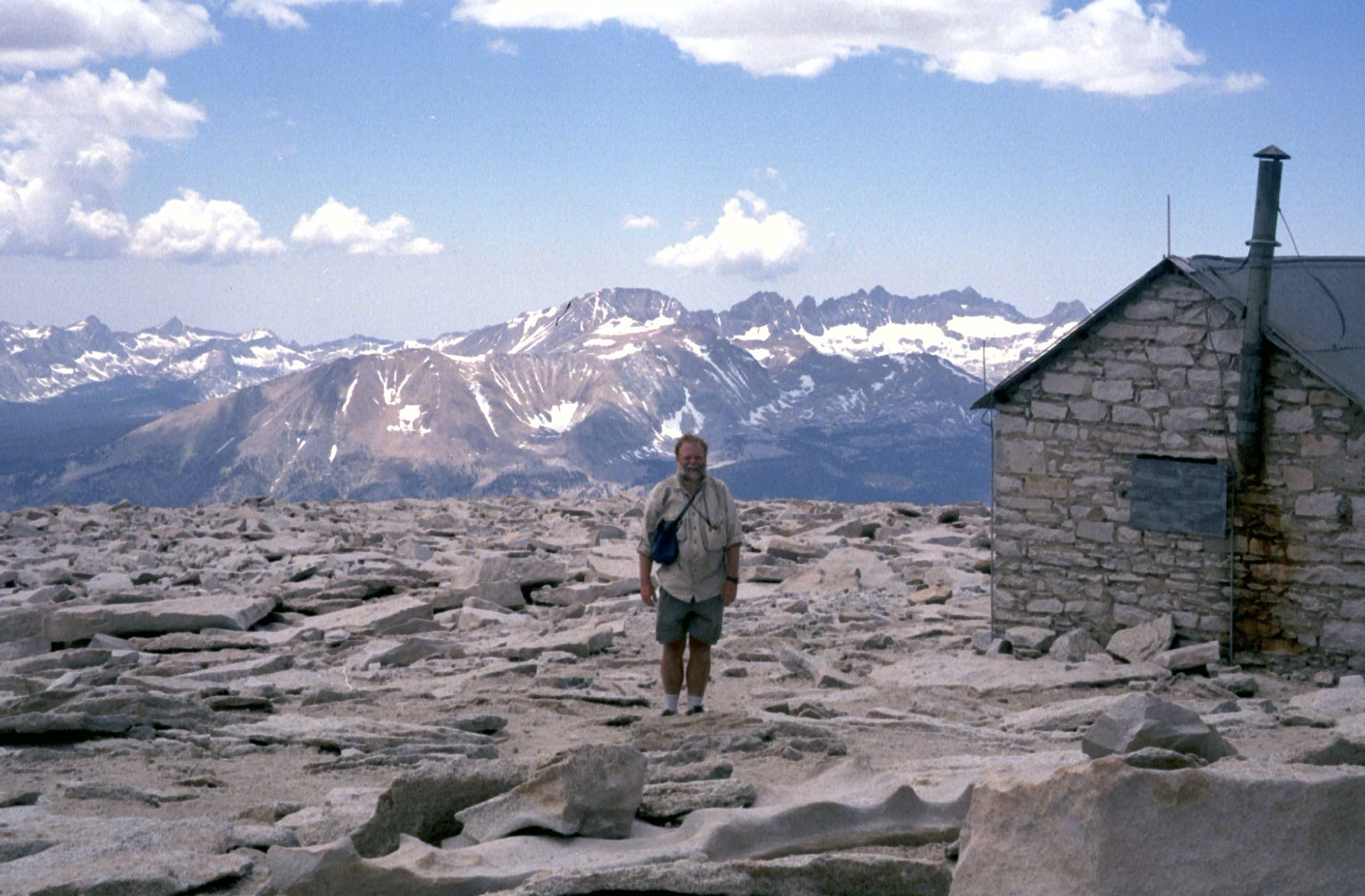
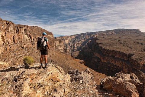
One of the highlights of trekking across the Hajars was the opportunity to climb Jebel Shams, the highest peak in the country at just shy of 10,000 feet. The trek to the summit from the plains below was a several day affair, as the first day climbed through Wadi Ghul, where the ruins of an abandoned mud-brick village contrasted with lime-green fields just below them. The route here traversed large rocks on a boulder-strewn ridge before descending into a wadi and then climbed eternally to reach a plateau above Wadi Nakhr, which is known as The Grand Canyon of Oman. Indeed, this section reminded us much of our trek along the Arizona Trail several years prior, only rockier and far more challenging.
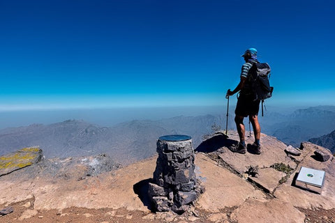
From our camp on the plateau, it was an 11 hour summit day, as the route wound up and down several wadis and over several false summits before finally running out of ascent at the summit register. From here we could see most of the route we’d been following for the past week, alternating mountains and valleys going on forever. From our high perch I reflected on how I’d trekked and climbed all over the world, from the Andes to the Himalayas and elsewhere, and in very few of these spots had experienced terrain as taxing, challenging, and savage as in Oman. Needless to say, the inner rewards were pretty great, not to mention the outer experiences, photos, and grandeur sitting right in front of me. If your hiking pinnacle has you jaded, start planning an Oman visit now!
Leave a comment
This site is protected by hCaptcha and the hCaptcha Privacy Policy and Terms of Service apply.