The plan was hatched on Saturday, July 22nd. I was sitting in my aunt’s kitchen in Alberton, MT, enjoying time with my relatives and taking a breather from my multi-month-long immersion into traveling and vanlife. I was aware of the Wonderland Trail primarily through news in the ultra-running world about people setting new Fastest Known Times (FKTs)for the 93-mile circumnavigation of Mt. Rainier. A loop trail around a volcano with a name that conjured up images of my childhood love of Alice in Wonderland? Sign me up! Not so fast. I knew that the coveted permits for this multi-day backpacking trip (I wasn’t quite ready for an FKT attempt!) were typically obtained in advance through a lottery system and went quickly. After a little research, I learned that the National Park Service holds ⅓ of the camping permits for walk-in Wonderland wannabes and I thought, “So you’re saying there’s a chance.”

Armed with a map and internet access, I dove into creating multiple possible trip itineraries in both directions, knowing that the odds of any one campsite being available were slim. While you don’t need a permit to hike the trail, you can only camp in designated campsites along the way. For those coveted patches of dirt, you do need a permit. The beauty of this type of backpacking trip is that you know exactly where you are going to sleep every night. The difficulty, of course, is in obtaining the permits.
Based upon the hiking I had been doing over the past several months (including a 5-day trip on the Oregon Coast Trail, which deserves its own special write-up), I decided I could do the trail in 4 full days. I packed up a food bag with four days of food, organized my gear in my backpack, and Pierre (my van) and I departed for Rainier on Monday, July 24th. My original plan was to camp outside the park near the White River entrance and arrive at the White River Ranger Station early Tuesday morning to stand in line and figure out if I could get enough campsite permits in the right places to make this work. As I got closer, I decided to go ahead and stop by the ranger station on Monday to gather information. Around 4:00 pm, I dropped into the park in drizzle and fog. The only things visible were the road and the wildflowers bursting with color alongside it. If a huge volcano slumbered close by, I was none the wiser. Rainier had chosen not to show herself on this day. There were no cars in line at the White River Entrance Station, nor was anyone in the White River Ranger Station except the rangers. I pulled out my map and my proposed itineraries and declared, “I want to backpack the Wonderland Trail!”- surely a phrase they hear multiple times per day. Lucky for me, they were kind and patient. As an Americorps intern pulled up the reservation system, the more seasoned ranger and I mulled over the map. “Are you sure you want to do it in 4 days? Where do you normally backpack? What have you done?” The ranger grilled me on my backpacking resume to make sure he knew exactly what I was capable of before agreeing to help me find a 4-day itinerary. After multiple attempts at a counterclockwise loop, we kept ending up with me doing 30-plus miles on the last day. Before I simply committed to that endeavor, we flipped it around and lo and behold, doing it clockwise would result in more evenly spaced days. I paid the $6 permit fee and walked out clutching my permit within half an hour of walking in. WHAT? I felt like the luckiest woman in the world! To me, the hardest part of this adventure was surely overcoming the obstacle of the permitting process… I was mistaken.

July 25, 2023. Day 1: White River Campground to Maple Creek Camp. 21.5 miles (4800 ft up/6500 ft down)
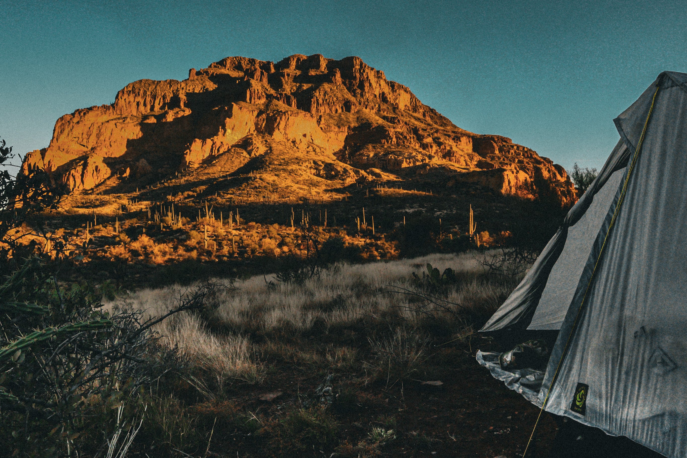
I began my hike on a cool, foggy morning with much excitement inside. I couldn’t believe I had scored permits to complete the Wonderland Trail. Within 5 minutes, I came to my first glacial river crossing over White River. The river was roaring, and the bridge sat only a few inches above the rushing water. Here we go! I soon found myself on a meandering trail covered in pine needles and surrounded by large trees. I practically skipped down the trail with joy. After several miles, I began the climb up to Panhandle Gap, which is the highest point on the Wonderland Trail at 6800 ft. For someone who lives near the San Juan Mountains in Colorado, this didn’t seem that high, until I realized I was climbing up from 3000 feet! I climbed and climbed through the mist and fog until I was above the treeline and merely following footprints across small snow fields to find the trail. As I got higher in the rocky steep terrain, I came across another hiker with a daypack, who quickly recognized my socks that had a Colorado logo on them and struck up a conversation. I was glad for the company as we traversed this section of trail- there was one particular sketchy snowfield that was not technically difficult but felt more daunting in the misty conditions. When we reached the top, we were greeted with an incredible view– of fog. Oh well! I felt bad for my new friend because he was just doing a day hike, but I knew I had many more views ahead. We said goodbye and I continued down. And down. And down. It was dramatic. I kept dropping so far that I was sure I would hit the sea. Indeed, the trail was living up to its name as I felt like Alice falling down the rabbit hole. Finally, the trail leveled off and I hiked right into Maple Creek campground- my home for night one. There were only 4 tent sites and one group site at this backcountry camp and they were all full. The National Park Service has done an excellent job at providing bear poles to hang food (awkward hooks til you get the hang of it!) and composting toilets at each campground and this one had a flowing creek close by. I started the ritual of setting up camp- dumping out the entire contents of my pack, pitching my Lunar Solo tent, arranging my bedding, and slapping at the flies and mosquitoes as they gradually sniffed out my fresh blood. I watched as the hikers next to me dried out clothes and sleeping bags on lines strung from trees- they had been caught in the rain that fell the day I drove into the Park. I was grateful that the skies were clearing and hoped they would remain so.

July 26, 2023. Day 2: Maple Creek Camp to South Puyallup River Camp. 22.8 miles. (6450 ft up/5144 ft down)
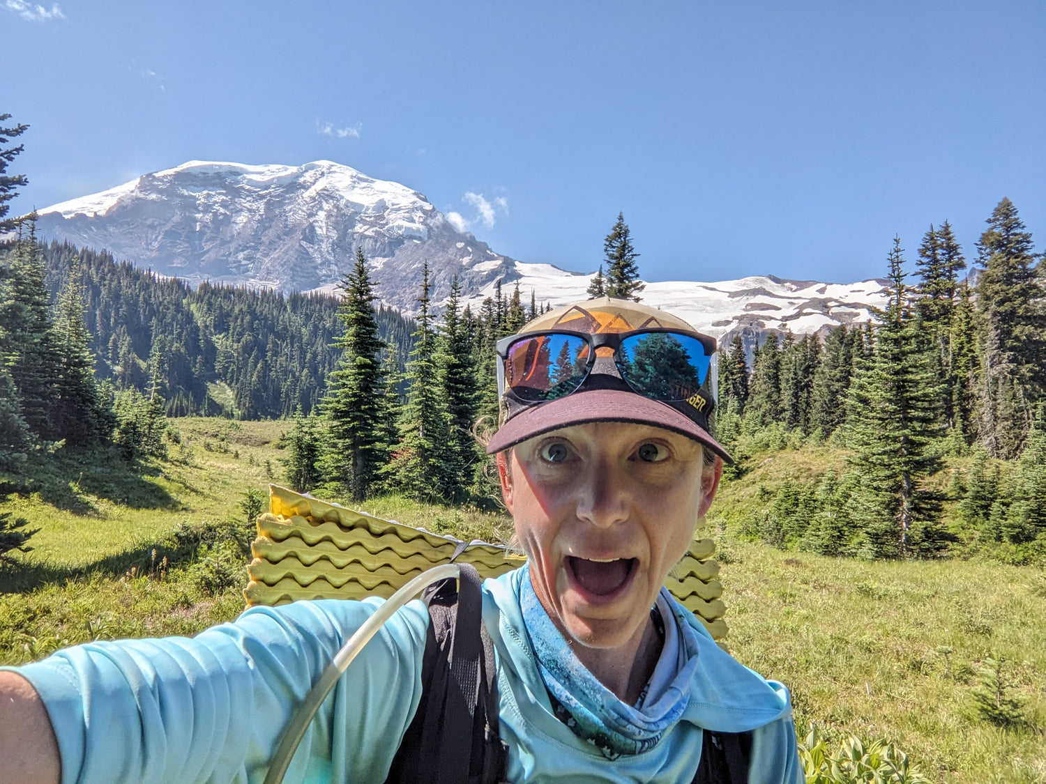
After breakfast, I began the hike out and up from Maple Creek Camp. The trail was steep and simply carved into washed-out sections of steep terrain in spots. Some waterfalls dotted the otherwise forested path as we climbed up to Reflection Lakes. AHA! Suddenly, I found myself out of the trees and staring straight at the snow-covered peak of Mt. Rainier. The sky was a deep blue and the air was as clear as spring water. It was a sight worth waiting for. A side trail led to Lake Louise and I, not wanting to pass up a lake view, took it. I then slightly cursed myself as I added more feet to the already stout elevation profile. Yes, let’s talk about the elevation profile for a moment which, during my preparation time, I failed to take into account. I suppose I felt a little overconfident from a life lived in the San Juan mountains. You may even say I was arrogantly naive to assume that a hike around the base of a volcano that never went over 7,000 feet wouldn’t have a challenging elevation profile. How wrong I was. That first day was just an introduction to the up up up and down down down down of this trail. The second day was a test of strength.
After pausing to admire Reflection Lakes, the trail once again descended as it meandered through deep forests toward the Longmire Visitor Center. As I approached the visitor center, I began to encounter groups of day hikers making the trek up to the waterfalls that were only a few miles journey from the parking area. Whenever I backpack, I always find it weird when I suddenly see people on trails with no backpack and missing the unpolished look of someone who slept in the woods. It seems like they all smell so fresh and clean- the laundry detergent and deodorant emanating from them when, in everyday life, I wouldn’t notice. Likewise, whenever I am day hiking and see a backpacker, I feel a little bit of envy at the adventures they must be having. I took the detour to the Longmire Lodge to get some fresh water and drool over food I couldn’t buy because I failed to pack any money or a credit card on this trip.

From Longmire, the trail once again climbs up and up past Devil’s Dream Campground and up to Mirror Lakes. Unlike the trek to Longmire, this stretch of trail was empty of hikers and I felt quite alone out there for several miles. As I approached the turnoff to Mirror Lakes trail, I came into a beautiful meadow with wildflowers and gentle streams with little wooden bridges to cross. A patrol cabin sits in one of those meadows near Indian Henry’s hunting ground and I felt as though I was looking at a painting with Rainier in the background, the light perfectly illuminating its peak. I dropped in elevation once again and began to hear the rushing waters of another glacial river- Tahoma Creek. In the place of the familiar wooden bridge for this crossing, hung a very tall and very long suspension bridge. The Tahoma Creek Suspension Bridge is 200 ft long and hangs 165 ft above the river- which feels even further as the bridge shakes and bounces with every footfall across. I quickened my steps, edged my hands along the cables, and reassured myself out loud as I made my way to the other side. Whew! The exhilaration of that crossing jolted me out of the walking nap I’d been taking down from Indian Henry’s hunting ground. This turned out to be a good thing, as I began the next climb up the steep terrain to Emerald Ridge. Once again, I was in awe at the view from the ridge, which was green with grass and wildflowers- a stark contrast to the rocky glacial terrain around the volcano. I lingered for a moment but had already covered over 20 miles for the day and was ready to take off my shoes and set up camp. The two-mile drop from Emerald Ridge to South Puyallup River Camp was steep and loose and anything but easy, but the lure of my final destination for the day pulled me on. Unlike the previous night, this backcountry camp was empty when I arrived, despite it being close to 6:00 p.m. After setting up my home for the night, I decided to take a closer look at the map and elevation profile for the next two days. Upon realizing that I had a lot of feet to climb and descend in my future, I ate some extra squares of chocolate and climbed into my sleeping bag.

July 27, 2023. Day 3. South Puyallup River Camp to Eagle’s Roost Camp. 23 miles (5974 ft up/5016 ft down)
I set out from camp ready for the familiar routine of climbing up to alpine views and descending deep into forests and down to rivers. Like the previous day, I started with a climb up to Klapatche Park and then a descent down to the North Puyallup River. This descent brought a little extra spice with some fallen trees to go under, over, and around, as well as some overgrown sections to forge through. I finally saw a few other people making their way up in the opposite direction. It’s always a little strange when you haven’t spoken to anyone in about 18 hours and open your mouth. As is usually the case, we chatted about where we’d been and what we’d seen for the other party to look forward to. From the North Puyallup River, the trail climbs at a nice even grade up to Golden Lakes. My legs felt strong from two days of tough hiking, and I powered up to a nice meandering trail that led to the lakes. Suddenly, I felt a pain in my left shin- not too sharp, but annoyed. I walked on and, as it improved slightly, I silently willed it to work itself out. Golden Lakes seemed an appropriate place to take a break for water filtering and lunch. Another patrol cabin sat between the lake and the trail, and I was surprised to see the door open, and a gentleman walk out on the porch. Hello! He said that he donates money to assist with trail maintenance and got to stay in the cabin for a night as a thank you. I smiled and thanked him for his generosity. The descent from Golden Lakes was full of long, gentle switchbacks that lulled me into a sleepy trance. I sang to myself and talked to the trees until I ran into some trail runners coming up from the other direction. Better make sure I appear sane, I thought. I reached the South Mowich River at an elevation of only 2600 feet. This river was wider than many of the others and the trail meandered through the rocks for a while. I was low on water and decided to filter out of the river and hope that the silt didn’t result in a clog. Another runner came by and stopped to chat. It turns out that he was part of a company called Aspire Adventures that was hosting a group of runners who would complete the trail in 3 days. Of course, they didn’t have to carry anything more than water and snacks as they would be provided food and sleeping quarters in the nights between the runs. Sounded pretty nice to me! Finally, I re-packed my filter and snacks for the final climb of the day. The rangers had suggested I take an alternative trail- the Spray Park Trail- to complete the loop. I was assured that the views were well worth the detour, so I took the recommendation. This meant that my camp that night would be at Eagle’s Roost, about 1.5 miles down the Spray Park Trail. If I stayed on the Wonderland Trail proper, I would go through the Mowich Lake area where there was an entrance and ranger station. The climbs were becoming routine, but my left shin, which had quieted down on the descent, began talking loudly to me. How could I be getting a shin splint? I felt my anxiety heighten but kept putting one foot in front of the other. As soon as I turned onto the Spray Park Trail, it was like I’d entered another world. I passed one group of day hikers after another. I hadn’t seen so many people in one place since Longmire and it felt odd after the solitude of the day. Suspecting that there may not be a close water source at the campsite, I filled up at one of the many streams I crossed along the way. While filtering, an older couple stopped to ask me about my journey and confirmed my suspicion and said that it looked like the closest water source to the camp was a quarter mile uphill- too far after a full day’s hike!
Eagle’s Roost Camp is perched on the side of a ridge among large conifer trees. Several hikers had already set up, but I found a peaceful spot to call home. I got to the business of setting up camp and then spent a while stretching, massaging, and cajoling my shin to feel better. I knew that my last day on the trail was going to be one of the hardest and I really hoped I wouldn’t have to limp through it. I went to bed feeling a little uneasy and set my alarm to get an earlier start.

July 28, 2023. Day 4. Eagle’s Roost Camp to White River Campground. 23 miles (6788 ft up/7274 ft down)
I awoke before my alarm and gingerly felt my shin. No pain! I crawled out of my sleeping bag to retrieve my food bag from the bear pole. No pain! Relief flooded through me as I happily made my last cup of coffee and oatmeal on the trail.
The Spray Park Trail did not disappoint. I climbed up to the alpine meadows while the sky glowed pink with the sunrise. Not a soul did I see in those first 5 miles, and I just took in the views of Rainier from the northern side. As was expected, the alpine terrain and views of the volcano disappeared as I descended down toward the Carbon River. The trail fell steeply, with large boulder steps and roots to navigate. By this point, I’d grown accustomed to the undulations of the Wonderland Trail, and the thought of a cold beer and cozy bed at the end of this day propelled me further. Another suspension bridge awaited me when I finally reached the Carbon River, but I crossed this one with more confidence and bravery. Climbing up and past Carbon Glacier was as steep as the trail had been and I marveled at the amount of water melting out of the glacier’s mouth. I came upon some of the runners from the Aspire group and found out that one of them was a doctor at Indian Health Services in Shiprock, NM, where I had once worked. Sometimes, the world seems so small. The fact that my shin pain had cleared so quickly made me so ecstatic that the climbs didn’t feel as steep as they had the previous days. Before I knew it, I found myself back up in the alpine terrain near Sunrise Visitor Center. The views from here were spectacular and reminded me a bit of the high country near Durango, Colorado- dirt paths cut into an otherwise sublime landscape crisscrossing up and down the mountains. By the time I started to see the day hikers coming up to the numerous trails that intersected with the Wonderland Trail, I realized I wasn’t quite ready for my hike to end. The simplicity of being on a beautiful trail with all you need on your back is so comforting, despite the physical discomfort that sometimes seeps in along the way. I dropped down past Sunrise and began the final descent into White River Campground. The last 3 miles were on a gentle grade through a forest and all of a sudden, I stepped onto the pavement and into the White River Campground. Just like that, it was done. Even though I’d hiked over 22 miles with almost 7,000 feet of climbing, I felt amazing and almost fresh. That’s the beauty of the hike. Without any fanfare, I pulled off my dirty shoes, put my backpack and trekking pole into my van, Pierre, and drove out of the park to find a spot to sleep for the night. I knew I’d sleep well and have a lazy morning over coffee while reflecting on the amazing adventure I’d just had. I had high expectations for the Wonderland Trail, and it truly delivered. I would recommend this trail for both new and experienced backpackers, as there are plenty of options to extend the time to complete it, along with places along the trail to cache food.

Gear List:
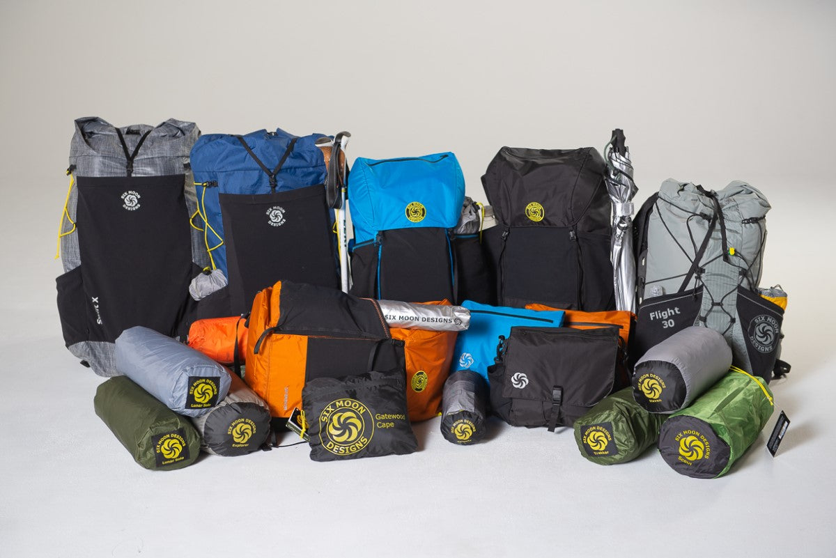
Pack: Six Moon Designs Swift V
Shelter: Six Moon Designs Lunar Solo
Trekking pole- Black Diamond Distance Carbon Z (just one that also doubled as the pole for my shelter)
Bag: Enlightened Equipment Revelation Sleeping Quilt with Cocoon Silk sleeping bag liner
Pillow: Sea to Summit Aeros Ultralight
Water System: 2L HydraPak bladder in the pack with Sawyer Squeeze filter and 2L Cnoc water bag for collecting from water source (I use an adaptor to filter the water through the hose of my bladder, which saves the effort of removing it from the pack. Highly recommend).
Stove: BRS Backpacking stove (plus small fuel canister)
Cook set: GSI Halulite Minimalist
Clothing: Rain jacket and pants, light down jacket, one pair shorts, one t-shirt, one long-sleeved sun shirt, 2 pairs of underwear, 3 pairs hiking socks, warm hat and light gloves, baseball cap and sunglasses
Shoes: Topos Mountain Racer 2
Watch: Coros Apex Pro
Food: Lots
Kindle
Small Flask of whiskey
Homemade first aid kit
Sunscreen
Bug spray
Bear spray


Leave a comment
This site is protected by hCaptcha and the hCaptcha Privacy Policy and Terms of Service apply.