

I needed something remote. Something that brought me to places that I didn’t even know about in an area that I’ve hiked a lot. The Grand Enchantment “Trail” scratched that itch this spring.
Some years, I find myself in the mood for a steady dose of hiker community. My partner Karma and I had that last year on round two of the CDT.
In other years, I want to get as remote as possible with as few people as possible. A route with many in-route options is a great way to do that.
Grand Enchantment Trail: The Basics
Created by Brett Tucker, the Grand Enchantment Trail moves in an indirect way between Phoenix and Albuquerque.
It is a unique southwestern route that:
- is roughly 770 miles (depending on the route choices you make).
- has one terminus in the Superstition Mountains east of Phoenix.
- has another terminus in the Sandia Mountains east of Albuquerque.
- is best hiked as a thru-hike in the spring going eastbound and, in the fall, going westbound.
- is part trail, part cross country, and part dirt/paved road.
- is a connector between the Arizona Trail (AZT) and the Continental Divide Trail (CDT) and then some extra.
Trail Direction & Timing
Since we wanted to start in the spring, we knew we needed to hike eastbound from Phoenix to Albuquerque. However, from having hiked the Arizona Trail, we knew that the first 125 miles or so would reach very hot temperatures.
So, for the first time, we decided to do a little section hiking! My hat now goes off to section hikers as I learned a whole new level of logistics.
We decided to do the GET in 4 sections: the Superstitions, the AZT overlap, Aravaipa Canyon to Klondyke, and Klondyke to Albuquerque. However, we loved Aravaipa Canyon so much, we hiked it twice, adding an extra 25 miles to our whole trip.
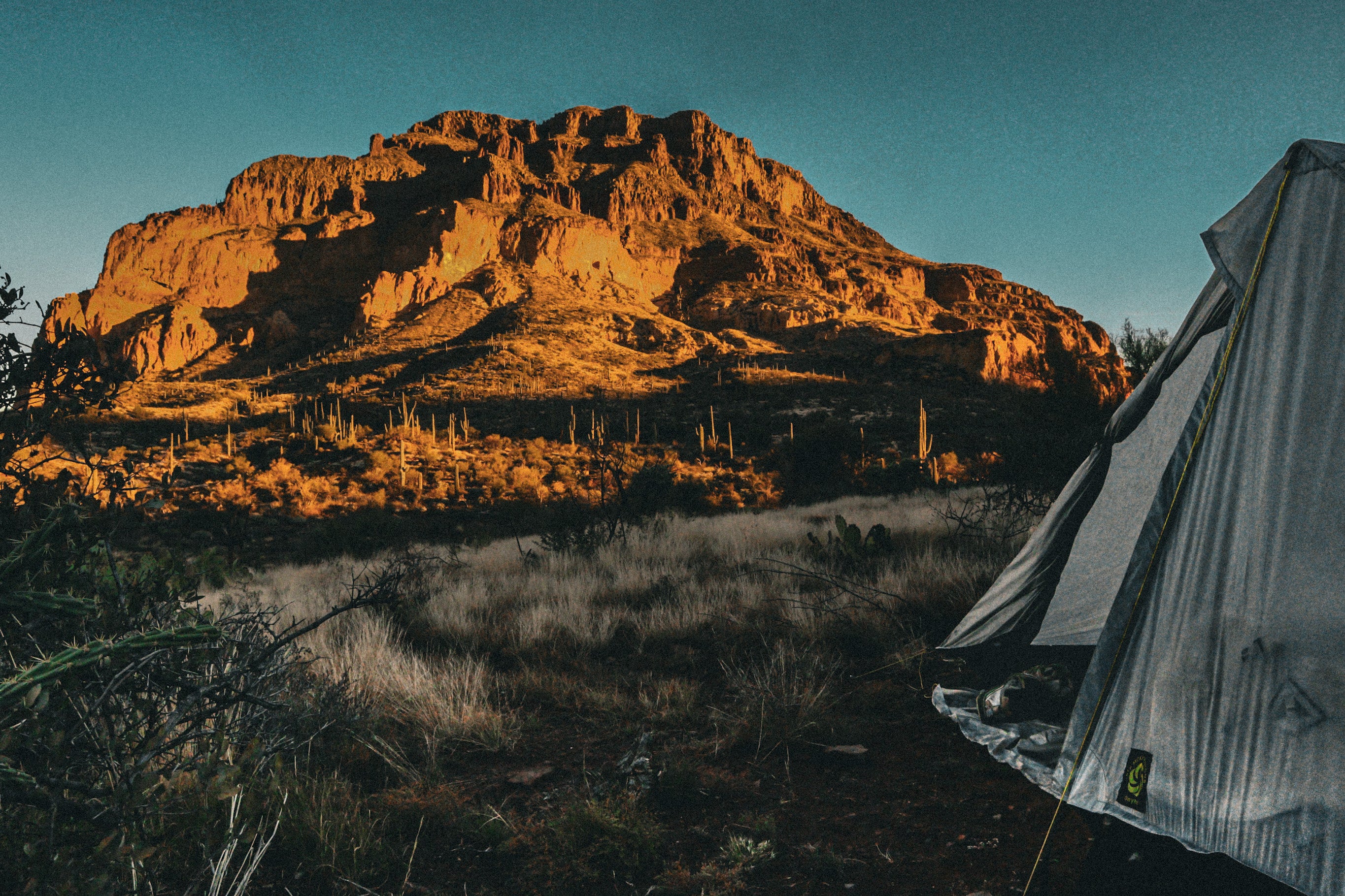
The Superstitions

Karma and I wintered down on southern Arizona public lands in our van and we got the trail itch a little sooner than we should have. When our buddy, Mavrik, called us and asked if we wanted to skip Christmas and hike the first 50 miles through the Superstitions, we jumped onboard.
Our first 50 miles of trail, Karma and I enjoyed laughing with our buddy and making a new friend in Shadow.
Nothing says bonding like finding nondescript, unmaintained trails full of catclaw instead of getting piles of unwanted things for Christmas.
What is catclaw you might ask? Catclaw, or Senegalia greggii, or “wait-a-minute bush” is native to the southwestern US and has thorns in the shape of a cat’s claw. Yes, I am utterly serious. It often grows into open space (i.e. unmaintained trail), and digs into your skin just like a cat. To get out of it, you must either back up and find another route or plow forward and bleed.
I elaborate so much because cat claw continues through most of the Arizona portion of the GET.
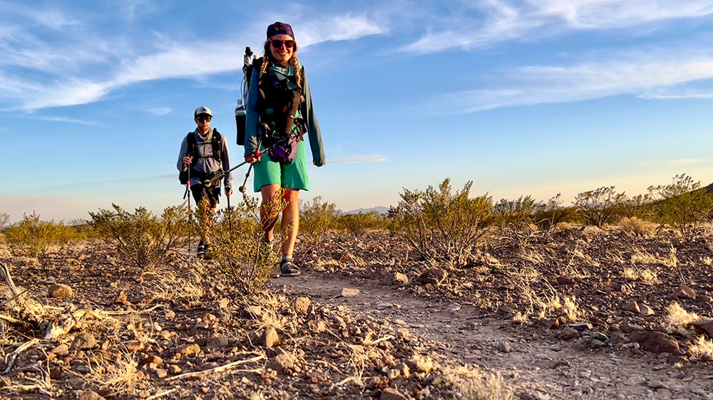
Arizona Trail Overlap

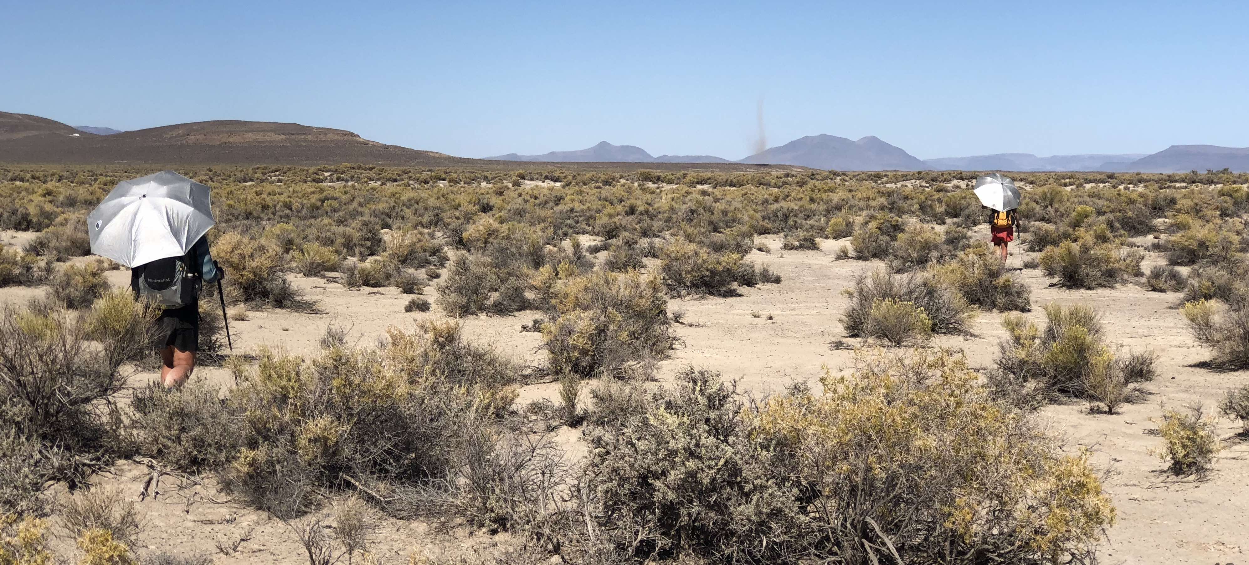
After that trip, Karma and I knocked out the lowest elevation portion that doubles as the AZT to AZ highway 77 which runs about 75 miles. Other than the lack of daylight, I loved hiking this section in January! It still became hot enough that we hiked in the mid-afternoon sun with our Silver Shadow umbrellas.
The GET diverged from the AZT twice here: once for Walnut Canyon and second to leave the AZT for good at Beehive Well. Both diversions proved excellent.
Aravaipa Canyon to Klondyke

Aravaipa Canyon is an amazing canyon nestled between Phoenix and Tucson and you need a permit. Yes, EVEN for a day hike. The BLM only allows 30 people per day via the west entrance and 20 per day via the east entrance.
Mavrik asked us if we wanted in on a late January permit. When we saw that all the permits were already gone for March and April, we agreed.
Armed with some seal skinz socks, the three of us set off into the freezing water. Twice its normal CFS due to a winter of heavy water, we had so much fun.
Klondyke to Albuquerque

As we tried to figure out how to get back to Klondyke, we dreamed of a cancellation permit for Aravaipa.
After refreshing the permit page about 50,000 times, on the way to Winco in Sacramento, boom. A total of 7 permits for April 12th appeared. It was April 5th. Karma and I snagged two and that became our plan.
We messaged Shiny and Half Double to see if they wanted to go and if they could give us a ride from Tucson. They happened to have plans already, but their friend Crush immediately got on and snagged the last permit, agreed to drive us, and then called us after buying the permit for details.
With Crush’s enthusiasm, we road-tripped out and began an adventure. Crush joined us not only for the first 8 miles of Aravaipa Canyon but also joined us in nerding out on all the wildlife we saw.
After he turned around, we hiked through Aravaipa Canyon into Turkey Creek Canyon and onto the rest of the GET.
The rest of the hike flowed like a normal thru-hike. We went through amazing areas that I had no idea existed, saw more wildlife than the whole CDT last year, and thoroughly got our egos checked in a few areas.
Some days we faced heat so strong we took our packs off and submerged ourselves completely in water. On other days, the mornings had such a bitter cold, we wore our Melanzanas and our puffy jackets.
We learned Brett Tucker’s cross-country style and got accustomed to steep, trailless sections.
The further we got into New Mexico, we learned a new level of what we called “rancher avoidance.” Our heads spun around the checkerboard of public and private land, all dutifully marked on the mapset.
Sometimes, while mountain ranges of “trail” had such extensive fire and flood damage, “trail” became cross-country.
And, it was all an adventure!
Water on the Grand Enchantment Trail
A misconception I often hear about this route is that you’re only in wide open desert. However, the Grand Enchantment Trail follows many canyons, often for miles and miles.
The southwest had a very wet winter over 2022-23. At the high elevations, snow piled up higher and higher. At the low elevations, torrential downpours filled valleys and flooded parking lots.
This boded well for water on the GET *IF* you left at the right window for the spring 2023 season. I believe we threaded that needle well. Those before us reported such high water that they took high water bypasses. Some water report notes spoke of waste-deep crossings.
Our deepest crossings were in the West Fork of the Gila and only 3 made it to my mid-thigh. At 5’2”, that means knee-deep for most people.
This wet winter also meant that water sources marked as “some potholes here” often had flowing water. Karma and I counted ourselves lucky to have such good water for so long on the trail.
Our timing also boded well for that wide open desert of New Mexico where you depend on cattle tire and trough sources. We walked through as many of those ranches were calving along the trail. Calves need a steady water source nearby, so these sources were turned on most of the time.
Trail vs Cross-Country vs Road Walks
Because of the name “Grand Enchantment Trail,” there is a common misconception that it is a trail in the sense of other long-distance trails. It is a route that uses trails, but also uses two-tracks, dirt roads, and paved roads, and often connects them with cross-country travel.
Personally, I love a good challenge. However, it is not for everyone. I think it’s important to build up thru-hiking skills on other trails first, then move into routes afterward.
“Trail” on the GET also means something different. Yes, there is legit trail where it overlaps with the AZT and the CDT. However, just because the GET map set says “trail” does not mean it’s been maintained in the last 10, 20, or even 30 years. With the increase in western wildfires, many lightly used trail systems have burned and subsequently flooded. You can often still find bits of trail, but often it becomes more of a guideline than an actual trail. I often found myself cross-country hiking roughly along the GPS track, then suddenly finding remnants of trail work a long time ago.
Country-country travel on the GET often consists of finding your own way along ranching fence lines. It could also have you following a ridgeline up or down to a specific point. Or, it can have you going up and down ridges sideways trying to avoid those ambiguous squares of private property that don’t actually make sense in the landscape. Here, it’s important to check and recheck the maps and get a good bearing.
Everyone rails on road walks. But, sometimes, you need them to get you to another area of awesomeness. The GET hardly uses paved roads, with the large exception of Section 36 through the Chilili Land Grant. There’s really no legal way through other than the paved road walk there.
Conclusion
Karma and I LOVED the GET overall. It gave us a good challenge. It took us to places we never knew existed in places we’d hiked and van camped nearby.
Who do I recommend it for? Anyone looking to get into routes who already knows how to thru-hike. With hardly any gear stores, it’s helpful to already have your gear situated. While it could be a first thru-hike, I think it would be better enjoyed after one has completed the CDT or another difficult western trail with a lot of extra navigation.

Leave a comment
This site is protected by hCaptcha and the hCaptcha Privacy Policy and Terms of Service apply.