

Sunshine Coast Trail British Columbia, Canada
Words and Photos By Tereza and Lubos
If you’re seeking a thrilling escapade, let me take you on a journey along the stunning Sunshine Coast Trail (SCT) in beautiful British Columbia, Canada. The SCT is a 180 km stretch of breathtaking landscapes and cozy cabins waiting for you at every turn. The exhilarating taste of the great outdoors made even better because we were sporting the most comfortable backpacks you could imagine!
The SCT stretches from Sarah Point to Saltery Bay, interspersed with sixteen welcoming
cabins, making it the longest hut-to-hut trail in Canada! As you trek through lush forests and alongside scenic coastlines, you’ll discover that this trail is not just a hike, it’s an invitation to reconnect with nature. Midway through the trail you will find the town of Powell River it is an excellent place to restock supplies and recharge batteries. Enjoy a hot shower, hearty meal, and a cold drink at a local pub.
The trail is completely free of charge, based on donation and no permits are necessary.
Ten days are recommended for a complete traverse, however it can be completed more quickly if you can spend more time on trial than enjoying the views of the ocean from the comfort of the cabins. We chose the trail, spoiler, we had some slight regret by day 4. Aside from the cabins, there aren’t many places to camp. It is wise to plan your days around cabin availability, which are spaced out six to sixteen kilometers from each other. Each cabin has several tent platforms and the cabins themselves can accommodate up to eight people (double in emergencies). We had only one week for vacation and our plan was to hike the entire trail in six days. After hiking the Pacific Crest Trail (PCT) and the Continental Divide Trail (CDT), we were well aware of our capabilities and knew the distances we could cover.
The SCT is wonderful because it offers multiple options for hiking. You can choose to hike the entire trail or individual sections. The day hike to Tin Hat is particularly popular; the view of the surrounding mountains and ocean is truly captivating. This spot perfectly embodies the essence of the west coast. Another intriguing option is to combine hiking and kayaking, as it’s possible to explore the area by water as well. The SCT is a hidden paradise on Earth where everyone can find something they love.

May 18-25, 2025 (5,5 days 167 km 7 292m 7 163m)
Our adventure began in Vancouver after work on a Friday. We drove to Horseshoe Bay and took the ferry to the Sunshine Coast. We made our way to Langdale before stopping in Sechelt for the night. It was late and the ferry to Saltery Bay wouldn’t leave until morning. Heavy rain had been forecasted for Saturday, so we decided to set off a day later and spend the day exploring the town. Our first night was spent in a wonderful resort cabin; enjoying unintended comfort and staying dry.
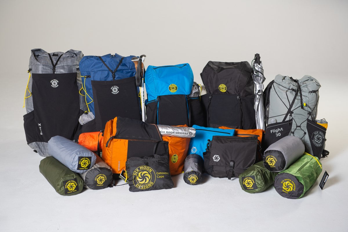
The next day, we took the ferry to Saltery Bay and then to Powell River. We stocked up on food for the days ahead and secured parking for our car. Conveniently, there’s a restaurant nearby, the Shingle Mill Pub. Parking is available for a small fee, this eliminated our worries about the car. Plus, we left some food in the car for the second half of the trail, lightening our packs. We were excited to test our new ultralight gear from Six Moon Designs.
The last task was to figure out how to get from Powell River to the trailhead. A shuttle service goes directly to the trailhead, but for two people, it would have cost nearly three hundred dollars, which we weren’t keen on paying. Improvisation is our specialty, so we devised a plan to take a bus (the stop was practically next to the restaurant where we parked) to Lund and then hitchhike from there. If that didn’t work, we could walk the approximately 14 km on a gravel road to the trailhead.
Day 1
23 km
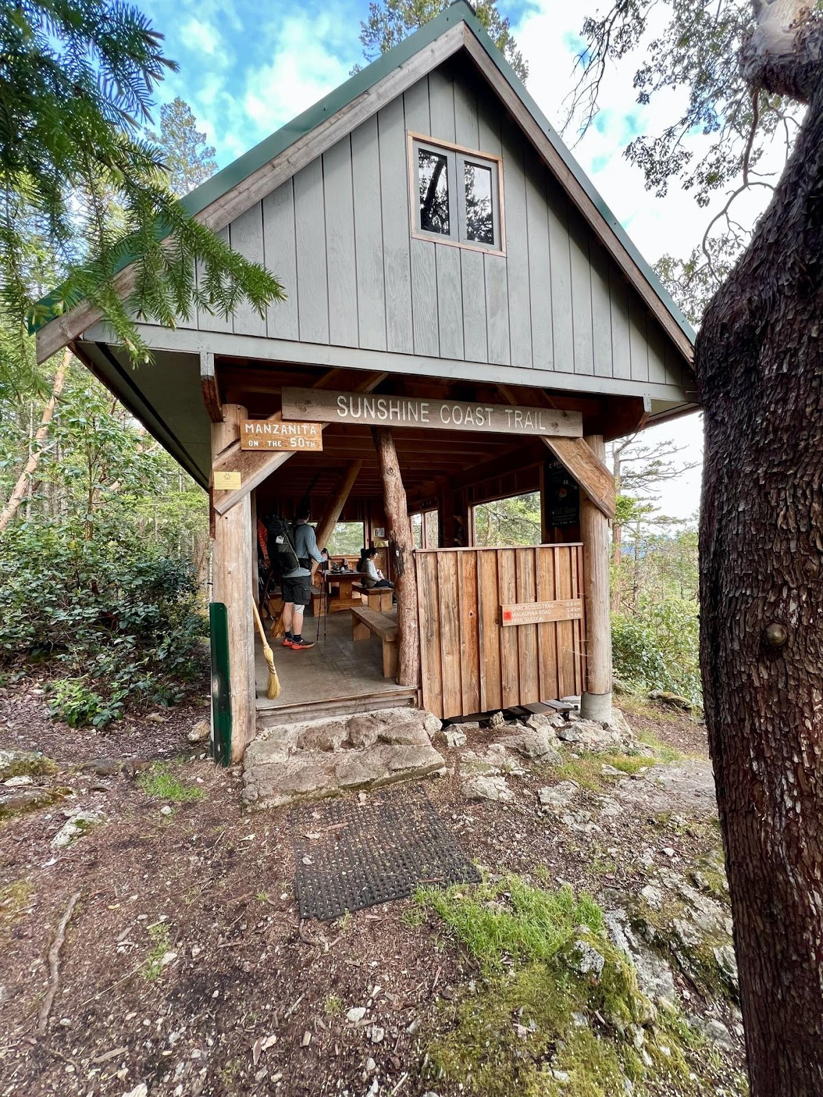
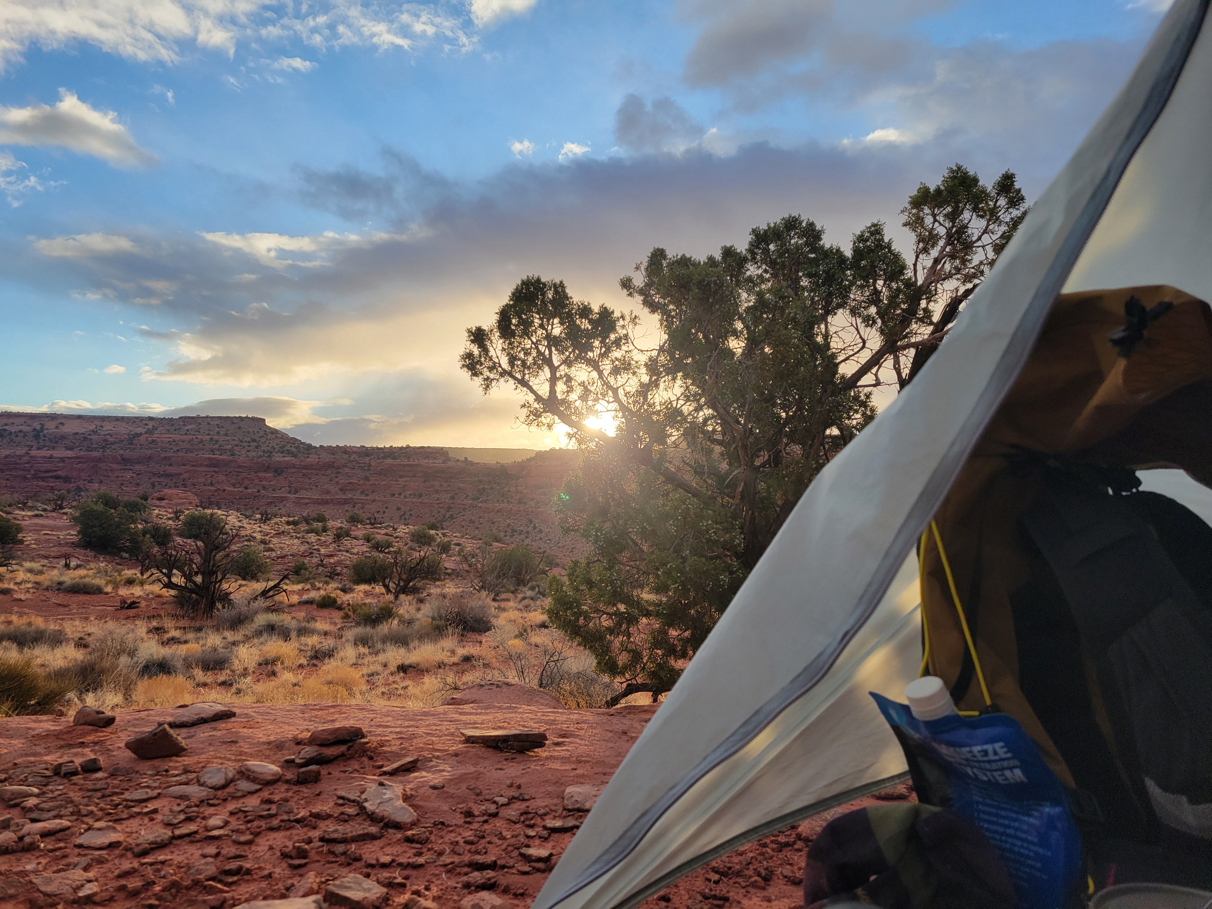
We took a $5 bus to Lund, it is the closest town to the trailhead. We arrived around 9:30 am where we grabbed coffee and chatted with some locals. They warned us about a cougar and a mother bear with three cubs in the area — not the best for our peace of mind! We started walking toward the trailhead, and before we could even begin hitchhiking, a driver stopped and offered us a ride, taking us as far as the road was passable. It was unexpectedly simple. We got out 4 km from the trailhead, and our adventure on the SCT began. We were finally back on the trail, where we feel most at home. The first hut, Sarah Point, gave us a stunning view of the ocean and surrounding islands. We exchanged waves with kayakers and continued onward. Initially, the trail ran along cliffs with waterfront views before entering a lush forest, soon we were surrounded by the rainforest. At the second hut, Bliss Portage, we utilized the outdoor seating for a snack break before heading to the next hut, Manzanita Hut, where we planned to spend the night. We were surprised by the number of people and tents there as we hadn’t encountered anyone on the way. The hut and its surroundings exceeded our expectations, and given the heavy rain forecasted for the night, we were grateful for the comfort inside.
Day 2
16 km
Today we had planned on a shorter day because of the hut locations and we wanted to pace ourselves. Surpisingly, we awoke feeling great, no stiff muscles or hot spots, not even in our shoulders. Quality gear is genuinely important. For me, the four most crucial items are quality hiking boots, backpack, sleeping pad, and sleeping bag. If any one of these don't fit or function perfectly, it results in discomfort.
We reached Rieveley Hut in the early afternoon, just as the rain began. The weather might not have been sunny, but we were thrilled nonetheless. The surrounding landscape, typical of the west coast, was filled with dense forests and an abundance of mosses and ferns thesize of small shrubs. As Europeans, we were enchanted by this “jungle.” The rainy atmosphere and fog only amplified the charm of the trail. Though we were practically right next to civilization, parts of the trail felt like we had been transported to another continent.
Day 3
33 km
We had a slower start to our morning, waking up at 8. Powell River, where we parked and stored supplies, was only fifteen kilometers away. We planned to have lunch at a restaurant there. While the first 75 km of trail appeared to be a pleasant flat stretch, in reality, it had been quite hilly since day one. While the climbs were not overwhelmingly steep (the bigger ones awaited us tomorrow), we faced nearly continuous small hills.
I was thrilled with my new "Minimalist V2" ultralight backpack, especially the vest harness design. Finally, I found a system that doesn’t constrict my breathing while going uphill! As a woman with a larger bust, finding a backpack that fits comfortably and properly distributes weight has always been a challenge. But now, thanks to the wider vest harness system, I can adjust it for perfect compression without feeling restricted, which allows me to breathe properly. It’s wonderful to finally have a functional setup that accommodates a physique like mine.
We arrived in town before 2 PM, during which we charged our power banks and refilled our water. Water sources were frequent along the trail, allowing us to carry less than two liters per person. In the afternoon, we walked along the ocean. If the weather had been nicer, it would have made for a perfect place to rest and swim. We passed tranquil beaches inviting us to camp. Why are ideal sleeping spots always halfway through the day, when you don’t need them?
As we returned to the forest, trekking through heavy rain, we concluded the day at Anthony Island Hut. It is a quaint little cabin that resembled something out of Jack London’s stories. Luckily for us, it was entirely empty. As we prepared for bed, we were startled by the sound of a bear grumbling outside, though we never encountered it. I was nearly asleep when Luboš woke me with his headlamp, and a bat flew by my head, sending the poor critter into a panic as it tried to navigate its newfound roommates. We opened the door for it, hoping to continue our slumber uninterrupted.

Day 4
20 km
This was definitely hardest day for us. We spent practically the entire morning going uphill. From the map, I suspected this section would lead me to question my life choices, and I was right. I decided that I'd rather my husband said “the uphill is over!” than "I love you!". Yet, the goal of the day was Tin Hat, which was why we set off on this whole SCT adventure. One must endure discomfort to savor the thrill of reaching the summit. At last, after a challenging day where the trail was complicated by bad weather, mud, slippery roots, and fallen logs, we arrived at Tin Hat. It felt like a fairytale. The rain had stopped and the clouds slowly parted, revealing the snow-capped peaks around us; the calm ocean sparkled below, dotted with numerous small islands. The air was refreshing, and birds serenaded us. Time seemed to stand still as happiness and harmony enveloped us. And, I knew that my life choices are right for me again.
Inside the cabin, we were greeted by a warm fire, dryness, and fellow hikers with whom we shared our Canadian adventure stories. It was paradise on Earth.

Day 5
48 km
We woke up alone in the cabin to see the sunrise. The descent was quite challenging, as there was a big blowdown on trail. I even tumbled a bit when we were climbing over logs and trudging through dense forest. My mind anxious that there was a cougar in the area, hoping it wasn’t hiding in the fallen trees. We took a short lunch break by Elk Lake. Most of the day was spent in the woods, occasionally we were rewarded with stunning views. Eventually, we finally experienced the promised combination of coastline and sunshine.
Just before 5 PM, we arrived at Walt Hill Hut, which was also empty. The view from the cabin was incredible. For a moment we considered staying but we didn’t want to spend the entire afternoon doing nothing. Having already warmed our legs up, we opted for an additional nineteen kilometers (hint: after ten kilometers downhill, with sore knees I kinda regretted this decision). The last kilometers were completed in darkness, passing the scenic sections around Lois Lake. Our last hut for the night was Golden Stanley. By the time we reached it, the hikers above us had already settled in for the night. We quietly unpacked and I went straight to bed without cooking.

Day 6
27 km
The week had flown by and it was hard to believe it was our final day on the SCT. We even hit snow at the top of the Mount Troubrige, having a quiet lunch by the shelter. Admittedly, this nearly six-day trek had taken a toll on us. It’s definitely not an easy hike. However, its diversity enchanted us. We fully intend to return and explore a combination of hiking and kayaking in the future.
The SCT ends close to the ferry terminal. We hitchhiked from the terminal, and received a ride immediately. They drove us to our car in Powell River. We arrived sore, happy and fulfilled with new memories. We definitely recommend this hike as well as our backpacks, as they exceeded our expectations.


Leave a comment
This site is protected by hCaptcha and the hCaptcha Privacy Policy and Terms of Service apply.