

3 nights | 37.59 miles | 8,622 ft elevation gain | 50°F-80°F
By Kirsten Anderson
DISCLAIMER: The Mount Adams circumnavigation via The Gap is an extremely challenging route that requires advanced navigation skills, glacier travel experience, and mountaineering abilities. This trip report reflects my personal experience and should not be considered a comprehensive guide. Before attempting this route, you must do your own thorough research, download multiple GPX tracks from various sources, obtain all required permits (including the time-sensitive Yakama Nation Tract D permit), and honestly assess your own skills and comfort level with untrailed terrain, glacier travel, and route finding. Conditions change, and what worked for us may not work for you. Always prioritize safety and be prepared to turn back if conditions or your abilities don't align with the demands of the route.
Follow along on more adventures: @littlestuff_pctsobo on Instagram
Read my other volcano circumnavigation reports: Timberline Trail around Mt. Hood

My husband stopped walking and pointed ahead. "Look—boot tracks. Someone's been through here."
We were nine hours into what should have been a five-mile day, somewhere on the eastern flanks of Mount Adams in a section known simply as "The Gap." The terrain around us was a chaotic jumble of loose rock and glacial moraine, and we'd been questioning our route for the last twenty minutes. The tracks led out onto a white expanse of glacier that seemed to drop off into nothing.
We moved closer to inspect them.
They were goat tracks.
The glacier before us looked like it fell into an abyss. Even with microspikes, one slip could be deadly. And if we somehow made it across, the rocky wall on the far side was steep, chossy, and crumbling, the kind of loose, rotten rock that spells disaster. I looked at Josh and said what we were both thinking: "Let's not follow a line if it doesn't feel right."
That decision to trust our gut over a GPS track, to assess and reassess every five to ten minutes, to move slowly and deliberately through untrailed, unforgiving terrain, defined our Mount Adams circumnavigation.
Why Mt Adams?
I've circumnavigated Mount Hood on the Timberline Trail and Mount St. Helens on the Loowit Trail—both stunning routes on established paths. Mount Adams was the natural next step, but it's entirely different. This route requires connecting multiple trails and navigating The Gap: a 5-7 mile untrailed section on Yakama Nation land that's only open several weeks each year and demands glacier travel, route finding, and expert-level mountain skills.

The Logistics
Getting permission requires advance planning. The Yakama Nation Tract D permit is only available during a limited window each year. I emailed in advance and was instructed to obtain the permit at a trailhead on the east side of the mountain before starting. This meant driving around to get the permit and pay the fee before backtracking to our starting point at South Climb Trailhead. We also purchased the $20 per person Mount Adams Summit Permit through Recreation.gov since we'd be above 7,000 feet.
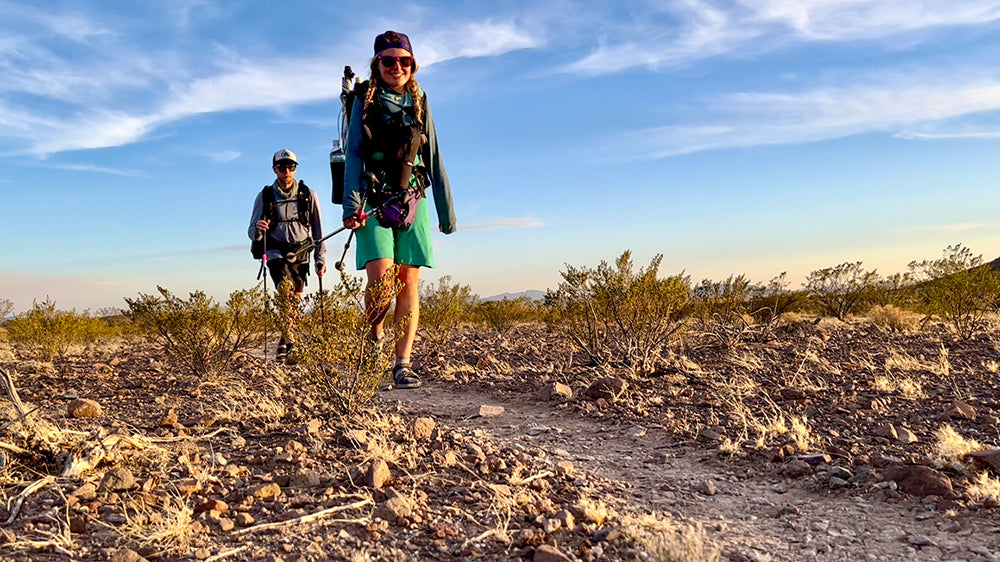
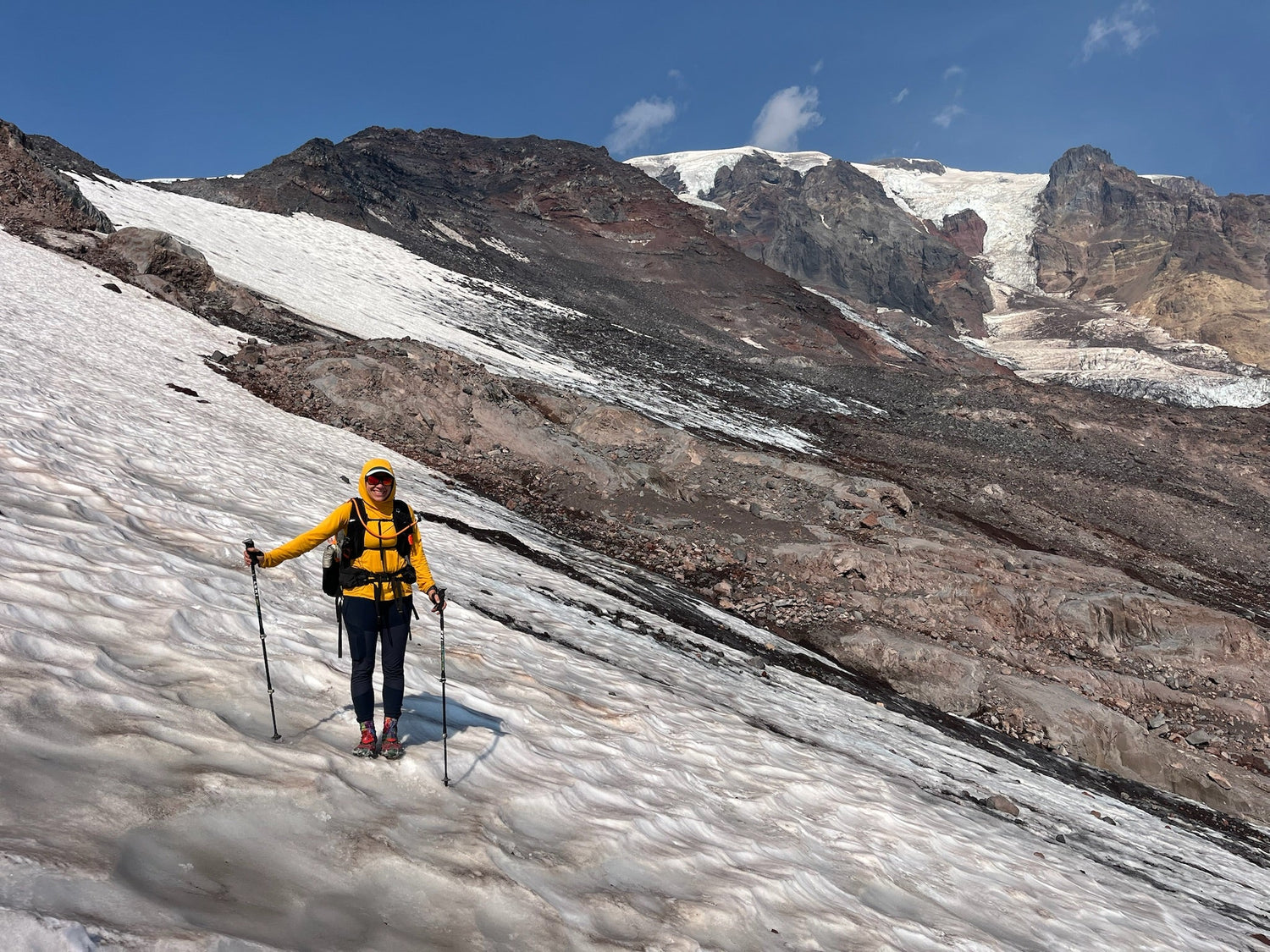
Beyond permits, we downloaded multiple GPX tracks from different sources, studied paper maps, and accepted we'd need to trust our own navigation. At the trailhead, I finished loading my Six Moon Designs Swift X pack and we headed out counter-clockwise.

Into Position
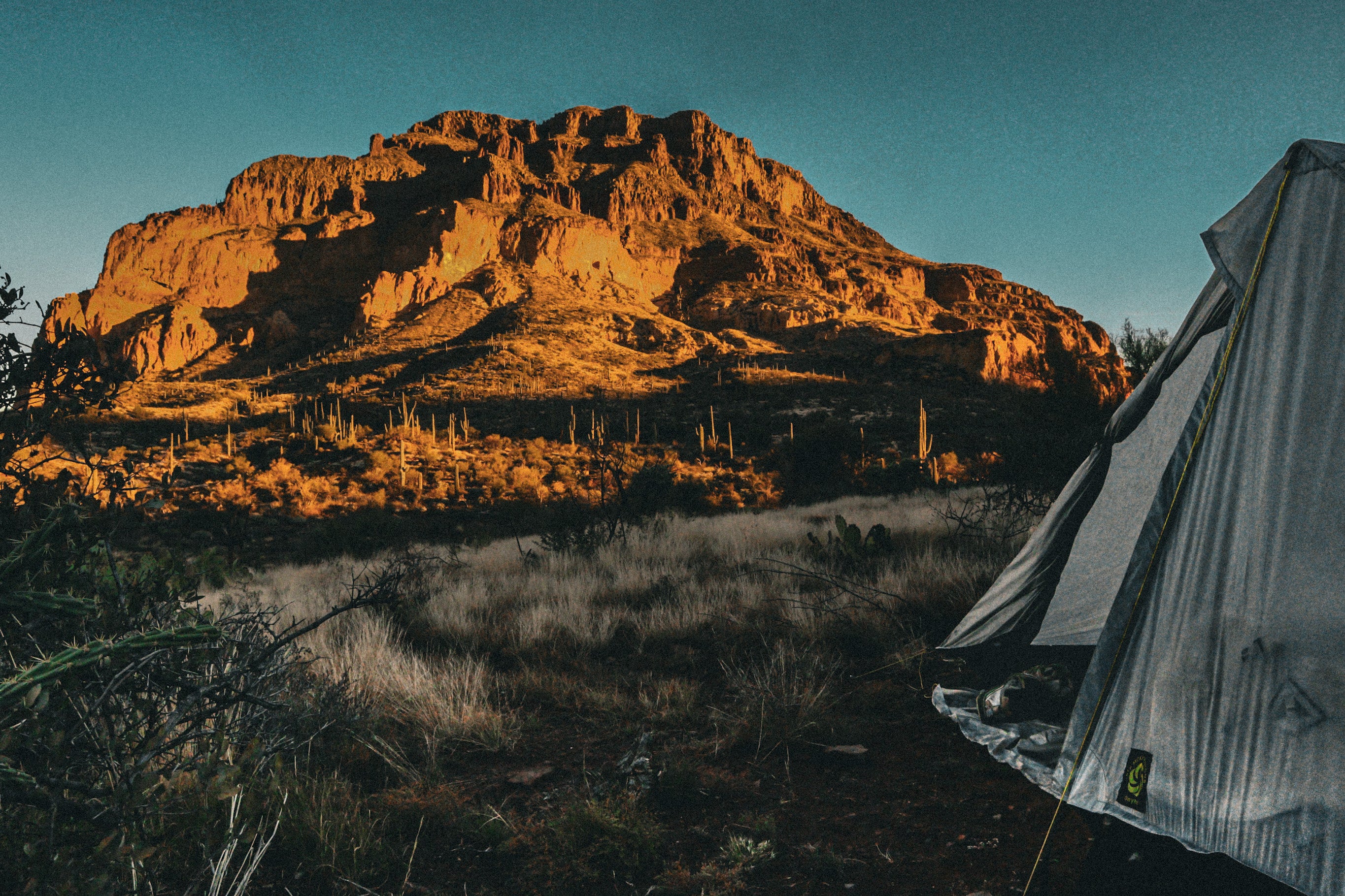
The first day covered seven miles and 2,500 feet of elevation gain through meadows and berry bushes to Iceberg Lake. Even on Labor Day weekend, we were the only campers there. The water was silty but usable. What we weren't prepared for was the wind. Even tucked behind a rock windscreen, the gusts were relentless. We deployed all the guy lines on our Six Moon Designs Haven Tent and secured everything. The tent buffeted and made noise, but it felt completely solid throughout the night. After a long day, it was reassuring to trust our shelter completely. And splitting the Haven's weight between us helped keep pack weights reasonable.

The Gap
Five miles in nine hours. This was the day that defined our circumnavigation.
The morning started with sunrise views and mountain goats on the slopes. After an initial climb, we started descending toward the glacier. Most reports suggested going counter-clockwise, which means descending rather than climbing the ice. We followed cairns as far as we could before stepping onto the glacier with microspikes.
The descent took about an hour, and my heart rate climbed with every step. At the bottom, I saw what I'd been dreading: crevasses splitting the ice, revealing nothing but darkness below. I could hear meltwater dripping into the void. That was my moment of panic. How stable was the ice around us? I couldn't wait to get off that glacier.
Once off the ice, we entered a different challenge: the moraine. These ridges of rock, gravel, and glacial sediment formed a massive debris field where everything wanted to slide out from under our trail runners. We traversed up and over, and up another giant moraine, terrified but making progress across the loose, unstable rock.
We weren’t moving fast, and it was mentally exhausting. Every five to ten minutes, we'd stop to check our various GPX tracks, assess the terrain, and determine the safest path forward. That's when the GPX track led us toward another glacier and Josh spotted what he thought were boot tracks, until we realized they were goat tracks. The glacier dropped off into what looked like an abyss, and the wall beyond was nothing but crumbling choss.
"Let's not follow a line if it doesn't feel right," I said. We backtracked and found our own way. That decision, repeated dozens of times throughout the day, is why it took us nine hours to cover five miles. We weren't physically exhausted—we were mentally drained from thinking about every foot placement and every water crossing for nine straight hours.
In the midst of The Gap's chaos, we found grace. Searching for a lunch spot, we stumbled upon a clear, flowing creek surrounded by wildflowers. We hadn't seen anything like it in this brutal section and it felt surreal. We immediately dropped our packs, filtered water, and ate lunch while gazing up at Mount Adams and its glaciers towering above us. We were standing on the east side of the mountain, a place few people ever explore. In that moment, surrounded by wildflowers with the mountain overhead, we understood: this is why we do this.
After lunch, the route finding continued through micro-valleys, creek crossings including the calf-deep muddy Rusk, and bush-whacking through vegetation. Water management was a constant challenge, we always carried too much because we never knew where the next source would be or whether it would be clear or muddy. Finally, we crested a hill to find Avalanche Valley Camp's open meadow with creeks, a waterfall, and two beautiful ponds.

At the end of Day 2, exhausted but safe, we reflected on what we had accomplished. This was probably the hardest hiking we had ever done, not because of distance or elevation, but because of the relentless decision making. But what made it manageable, what got us through those nine hours, was our partnership. The constant communication, the patience when one of us needed to stop and reassess, the grace we gave each other when doubt crept in. We didn’t just navigate The Gap together, we leaned on each other through every uncertain step. That matters more than any summit or mileage total ever could.

Back to Trail Life
Route finding continued from Avalanche Camp to Devils Garden with minimal trail and constantly looking for the next cairn. After crossing the Yakama Nation boundary at Devils Garden, the established trail resumed. We heard a glacier calving somewhere on the mountain, loud and dramatic even though we couldn't see it. From here, we crossed exposed lava fields before entering green forest again.
Then everything changed. We reached the PCT junction, and suddenly we were back on the super cruiser soft, cushy, gorgeous trail that thousands hike each year. The mental load of navigation vanished. All we had to do was walk. We counted thirty thru-hikers in just a few miles and camped among nine tents at Riley Creek, meeting section hikers, thru-hikers, and two guys who'd just flown in from Europe. Our final night was at the same PCT spot where I'd camped in 2022 during my Washington section, a perfect full-circle moment.

Should You Attempt This Circumnavigation?
Let me be direct: The Gap should only be attempted by very experienced hikers who have confidence on glaciers, experience with moraine travel, and skills in route finding. It is not for the faint of heart. There is no trail, no single route to follow. Compare that to the Round the Mountain trail and the PCT sections, which feel like cruiser highways. The difference is stark.
If you're considering this route, you must:
- Do thorough research and download multiple GPX tracks from different sources
- Carry paper maps and know how to use them
- Feel confident in steep mountain terrain and glacier travel
- Be prepared to make real-time navigation decisions
- Accept that it will be slow, mentally exhausting, and potentially dangerous
But would I trade the experience? No. Standing on the east side of Mount Adams in places few people ever see, finding that creek oasis, and completing a circumnavigation that connected established trails with true wilderness navigation, that's the spiciest hiking I've done. At the beginning, I felt excited but nervous. By the end, I felt confident in our abilities and proud of what we'd accomplished, but also deeply relieved to be done.
Mount Adams tested us in ways Mount Hood and Mount St. Helens didn't. It demanded more: more permits, more planning, more navigation skills, more mental toughness. For those ready for that challenge, Mount Adams awaits. Just make sure you're truly ready for The Gap.
For more information on permits: Yakama Nation Tract D and Mount Adams Summit Permit
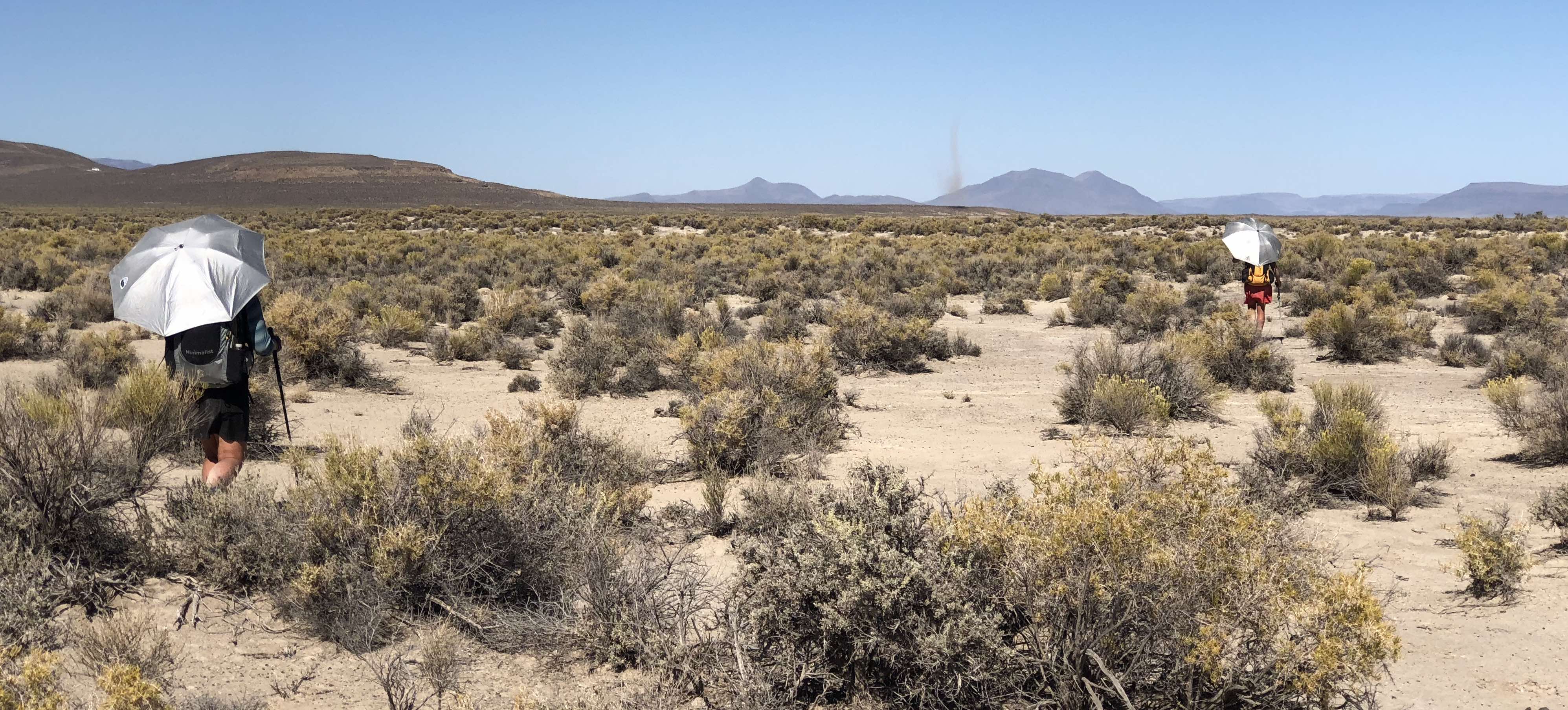
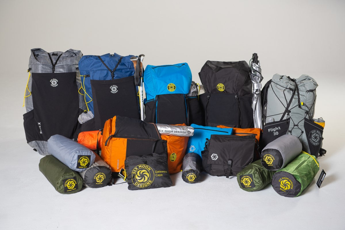
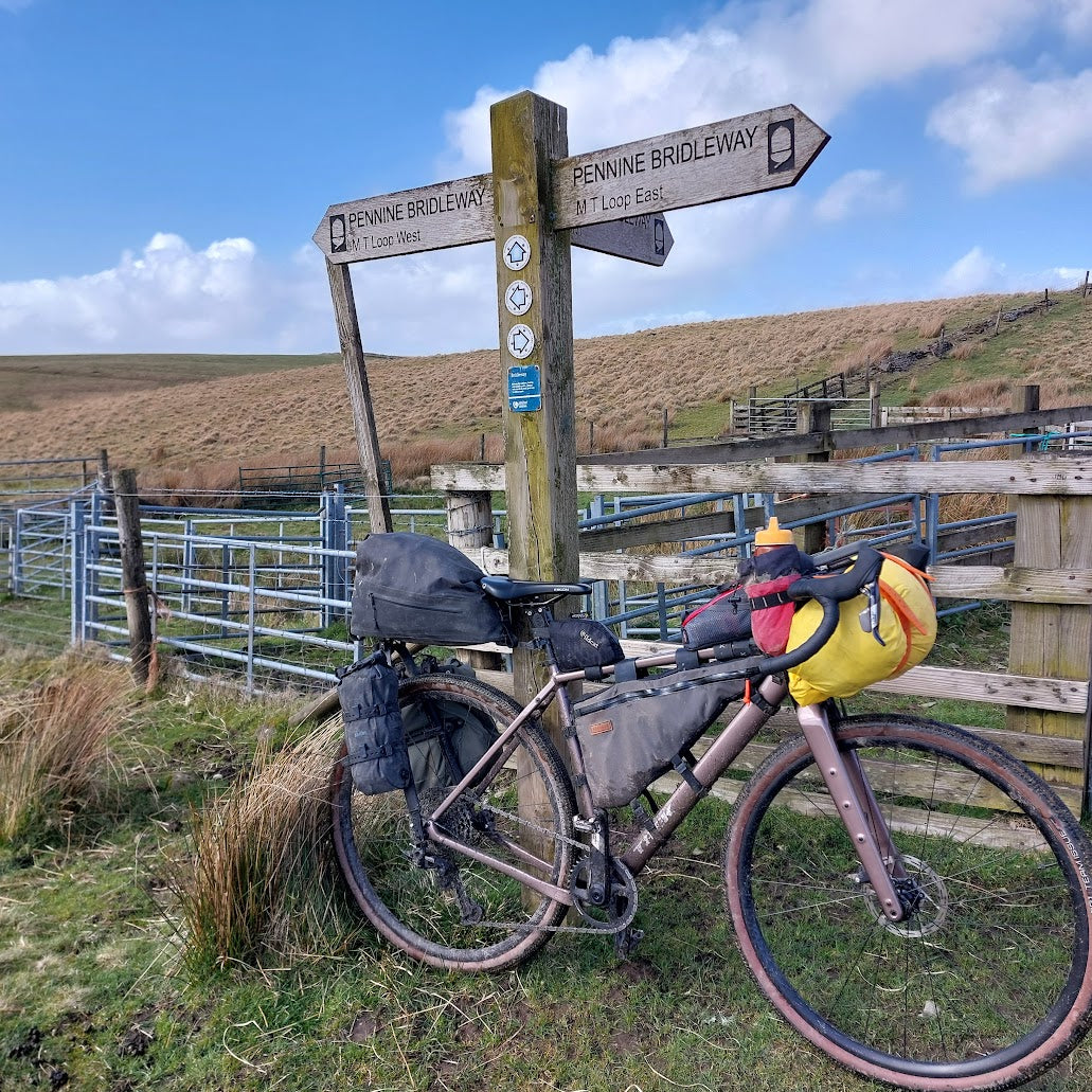
Gear used: Six Moon Designs Haven Tent, Swift X Backpack, and Silver Shadow Carbon Umbrella
Leave a comment
This site is protected by hCaptcha and the hCaptcha Privacy Policy and Terms of Service apply.